

Bergsrunde um Freital
A cycling route starting in Freital, Saxony, Germany.
Overview
About this route
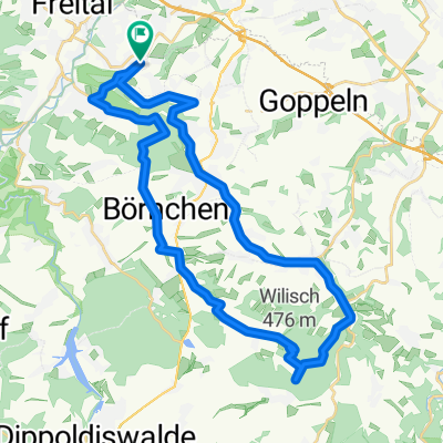
Freital - Somsdorf - Löbau - Edle Krone - Tharandt - Hartha - Braunsdorf - Freital
- -:--
- Duration
- 39.1 km
- Distance
- 540 m
- Ascent
- 542 m
- Descent
- ---
- Avg. speed
- 394 m
- Max. altitude

Route quality
Waytypes & surfaces along the route
Waytypes
Road
16 km
(41 %)
Quiet road
7 km
(18 %)
Surfaces
Paved
33.3 km
(85 %)
Unpaved
0.8 km
(2 %)
Asphalt
32.1 km
(82 %)
Concrete
1.2 km
(3 %)
Continue with Bikemap
Use, edit, or download this cycling route
You would like to ride Bergsrunde um Freital or customize it for your own trip? Here is what you can do with this Bikemap route:
Free features
- Save this route as favorite or in collections
- Copy & plan your own version of this route
- Sync your route with Garmin or Wahoo
Premium features
Free trial for 3 days, or one-time payment. More about Bikemap Premium.
- Navigate this route on iOS & Android
- Export a GPX / KML file of this route
- Create your custom printout (try it for free)
- Download this route for offline navigation
Discover more Premium features.
Get Bikemap PremiumFrom our community
Other popular routes starting in Freital
 Rundkurs Gompitz Nossen Meisen
- Distance
- 63.9 km
- Ascent
- 515 m
- Descent
- 642 m
- Location
- Freital, Saxony, Germany
 Freital Tharandt Dorfhain Ruppendorf Paulsdorf Freital
- Distance
- 33 km
- Ascent
- 369 m
- Descent
- 375 m
- Location
- Freital, Saxony, Germany
 Burgwartstraße 17A, Freital nach Burgwartstraße 17B, Freital
- Distance
- 57.6 km
- Ascent
- 788 m
- Descent
- 793 m
- Location
- Freital, Saxony, Germany
 Im Weißeritztal und im Müglitztal entlang der Eisenbahn
- Distance
- 75.1 km
- Ascent
- 1,137 m
- Descent
- 1,147 m
- Location
- Freital, Saxony, Germany
 Rundfahrt über Plauenscher Grund
- Distance
- 19.5 km
- Ascent
- 223 m
- Descent
- 223 m
- Location
- Freital, Saxony, Germany
 Himmelfahrt 2010
- Distance
- 33.8 km
- Ascent
- 553 m
- Descent
- 555 m
- Location
- Freital, Saxony, Germany
 1. Ausfahrt
- Distance
- 16.9 km
- Ascent
- 223 m
- Descent
- 232 m
- Location
- Freital, Saxony, Germany
 ... mal auf einem anderen Weg nach Meißen.
- Distance
- 91.5 km
- Ascent
- 399 m
- Descent
- 399 m
- Location
- Freital, Saxony, Germany
Open it in the app