

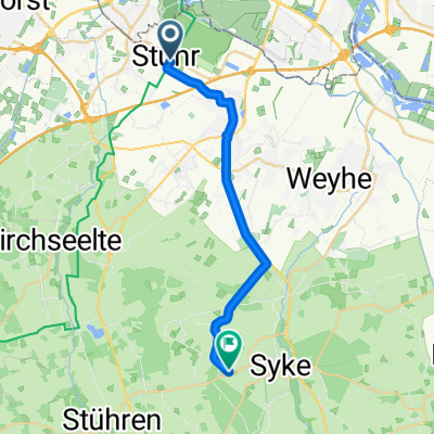
Ochtum-Tour
A cycling route starting in Stuhr, Lower Saxony, Germany.
Overview
About this route
- -:--
- Duration
- 8.4 km
- Distance
- 8 m
- Ascent
- 8 m
- Descent
- ---
- Avg. speed
- 6 m
- Max. altitude
Continue with Bikemap
Use, edit, or download this cycling route
You would like to ride Ochtum-Tour or customize it for your own trip? Here is what you can do with this Bikemap route:
Free features
- Save this route as favorite or in collections
- Copy & plan your own version of this route
- Sync your route with Garmin or Wahoo
Premium features
Free trial for 3 days, or one-time payment. More about Bikemap Premium.
- Navigate this route on iOS & Android
- Export a GPX / KML file of this route
- Create your custom printout (try it for free)
- Download this route for offline navigation
Discover more Premium features.
Get Bikemap PremiumFrom our community
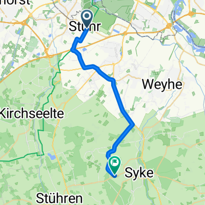
Other popular routes starting in Stuhr
 Route-Stuhr-73
- Distance
- 72.9 km
- Ascent
- 165 m
- Descent
- 161 m
- Location
- Stuhr, Lower Saxony, Germany
 Rund um Weyhe
- Distance
- 33 km
- Ascent
- 20 m
- Descent
- 19 m
- Location
- Stuhr, Lower Saxony, Germany
 Kleiner Rundkurs Brinkum-Bremen
- Distance
- 31 km
- Ascent
- 53 m
- Descent
- 52 m
- Location
- Stuhr, Lower Saxony, Germany
 Riede arsten
- Distance
- 27.6 km
- Ascent
- 17 m
- Descent
- 20 m
- Location
- Stuhr, Lower Saxony, Germany
 Grollander See & zurück
- Distance
- 24.9 km
- Ascent
- 20 m
- Descent
- 21 m
- Location
- Stuhr, Lower Saxony, Germany
 От L337 до Melitta-Bentz-Ring
- Distance
- 16.8 km
- Ascent
- 52 m
- Descent
- 10 m
- Location
- Stuhr, Lower Saxony, Germany
 Weyhe-Ristedt.Syke-Weyhe
- Distance
- 27.1 km
- Ascent
- 55 m
- Descent
- 52 m
- Location
- Stuhr, Lower Saxony, Germany
 От L337 до Melitta-Bentz-Ring
- Distance
- 17.9 km
- Ascent
- 49 m
- Descent
- 6 m
- Location
- Stuhr, Lower Saxony, Germany
Open it in the app