

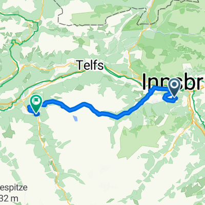
Innsbruck Route Großer Solberg
A cycling route starting in Völs, Tyrol, Austria.
Overview
About this route
Anstige Neue Marburger Hütte, Zirler Schützensteig, Großer Solberg, wieder zur Neue Marburger Hütte. Dann via Hechenberglweg oder nch über das Kirchbergköpfle wieder zum Start
- -:--
- Duration
- 17.4 km
- Distance
- 2,216 m
- Ascent
- 2,214 m
- Descent
- ---
- Avg. speed
- 2,514 m
- Max. altitude

Continue with Bikemap
Use, edit, or download this cycling route
You would like to ride Innsbruck Route Großer Solberg or customize it for your own trip? Here is what you can do with this Bikemap route:
Free features
- Save this route as favorite or in collections
- Copy & plan your own version of this route
- Sync your route with Garmin or Wahoo
Premium features
Free trial for 3 days, or one-time payment. More about Bikemap Premium.
- Navigate this route on iOS & Android
- Export a GPX / KML file of this route
- Create your custom printout (try it for free)
- Download this route for offline navigation
Discover more Premium features.
Get Bikemap PremiumFrom our community
Other popular routes starting in Völs
 Völs-Kematen-Sellrain-Gries-St. Sigmund-Haggen-Kühtai-Ötz-und zurück
- Distance
- 92.1 km
- Ascent
- 3,151 m
- Descent
- 3,140 m
- Location
- Völs, Tyrol, Austria
 Innsbruck - Scuol
- Distance
- 138.5 km
- Ascent
- 1,050 m
- Descent
- 372 m
- Location
- Völs, Tyrol, Austria
 Kühtai Sattel 2009
- Distance
- 55.3 km
- Ascent
- 1,805 m
- Descent
- 1,740 m
- Location
- Völs, Tyrol, Austria
 kleine Innsbrucker Nordkettenrunde
- Distance
- 20.2 km
- Ascent
- 697 m
- Descent
- 695 m
- Location
- Völs, Tyrol, Austria
 Alpequer3
- Distance
- 237.3 km
- Ascent
- 4,005 m
- Descent
- 4,180 m
- Location
- Völs, Tyrol, Austria
 von Innsbruck nach Cavaion am Gardasee
- Distance
- 418.8 km
- Ascent
- 2,288 m
- Descent
- 2,648 m
- Location
- Völs, Tyrol, Austria
 Innsbruck Route Großer Solberg
- Distance
- 17.4 km
- Ascent
- 2,216 m
- Descent
- 2,214 m
- Location
- Völs, Tyrol, Austria
 Campingplatz Kranebitten - Höttinger Alm
- Distance
- 12.8 km
- Ascent
- 996 m
- Descent
- 122 m
- Location
- Völs, Tyrol, Austria
Open it in the app