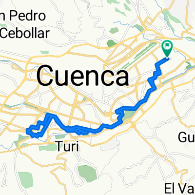
Ruta a Del Bandoneón 59, Cuenca
- 21.2 km
- 257 m
- 134 m
- Cuenca, Azuay, Ecuador
A cycling route starting in Cuenca, Azuay, Ecuador.
Overview
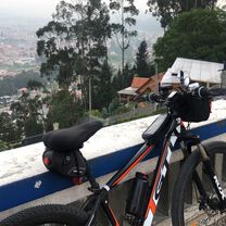
3 hour trip, 2 ½ to get to the top of Barabon and ½ to get back to Cuenca. After following highway to Cajas for 5 kms turn left onto dirt. Not technical but non-stop climb until the paramo. Great views over Cuenca and panoramas of distant mountains. Total vertical climb 1000 m
created this 14 years ago
Route quality
Quiet road
4.9 km
(34 %)
Path
2.3 km
(16 %)
Paved
5.5 km
(38 %)
Unpaved
7.7 km
(53 %)
Unpaved (undefined)
6.5 km
(45 %)
Asphalt
3.9 km
(27 %)
Continue with Bikemap
You would like to ride Cuenca to Barabon CLONED FROM ROUTE 880595 or customize it for your own trip? Here is what you can do with this Bikemap route:
Free trial for 3 days, or one-time payment. More about Bikemap Premium.
Discover more Premium features.
Get Bikemap PremiumFrom our community
Open it in the app