Măneciu-Clăbucet-Pleșu-Suzana
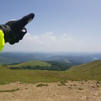
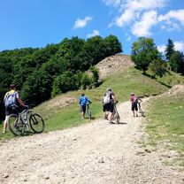
A cycling route starting in Măneciu-Ungureni, Prahova, Romania.
Overview
About this route
Măneciu-Clăbucet-Pleșu-Suzana (bulina albastra)
- -:--
- Duration
- 19.3 km
- Distance
- 1,081 m
- Ascent
- 910 m
- Descent
- ---
- Avg. speed
- 1,377 m
- Avg. speed
Continue with Bikemap
Use, edit, or download this cycling route
You would like to ride Măneciu-Clăbucet-Pleșu-Suzana or customize it for your own trip? Here is what you can do with this Bikemap route:
Free features
- Save this route as favorite or in collections
- Copy & plan your own version of this route
- Sync your route with Garmin or Wahoo
Premium features
Free trial for 3 days, or one-time payment. More about Bikemap Premium.
- Navigate this route on iOS & Android
- Export a GPX / KML file of this route
- Create your custom printout (try it for free)
- Download this route for offline navigation
Discover more Premium features.
Get Bikemap PremiumFrom our community
Other popular routes starting in Măneciu-Ungureni
- Maneciu, catre Tabla Butii, Valea Stinii, Cheia, Maneciu
- Distance
- 55.6 km
- Ascent
- 1,169 m
- Descent
- 1,169 m
- Location
- Măneciu-Ungureni, Prahova, Romania
- Maneciu - Pasul Boncuta - Maneciu CLONED FROM ROUTE 63456
- Distance
- 35.1 km
- Ascent
- 595 m
- Descent
- 587 m
- Location
- Măneciu-Ungureni, Prahova, Romania
- Tura maneciu
- Distance
- 51.9 km
- Ascent
- 0 m
- Descent
- 0 m
- Location
- Măneciu-Ungureni, Prahova, Romania
- Muntii Tataru - Vf. lui Crai
- Distance
- 49.2 km
- Ascent
- 1,076 m
- Descent
- 1,076 m
- Location
- Măneciu-Ungureni, Prahova, Romania
- Cheia MTB Challenge 2014
- Distance
- 49.8 km
- Ascent
- 1,121 m
- Descent
- 1,121 m
- Location
- Măneciu-Ungureni, Prahova, Romania
- eMTB Maneciu-Slon-Tabla Butii-Cascada Schinda
- Distance
- 55.7 km
- Ascent
- 1,669 m
- Descent
- 1,655 m
- Location
- Măneciu-Ungureni, Prahova, Romania
- Tura Ocolul Ciucasului
- Distance
- 97.1 km
- Ascent
- 1,628 m
- Descent
- 1,626 m
- Location
- Măneciu-Ungureni, Prahova, Romania
- Creasta Muntilor Tataru
- Distance
- 49.1 km
- Ascent
- 1,095 m
- Descent
- 1,090 m
- Location
- Măneciu-Ungureni, Prahova, Romania
Open it in the app