

Nasty, Romans and Vogons.
A cycling route starting in Knebworth, England, United Kingdom.
Overview
About this route
The text and routes in these mapping apps are based on content in my blog where you can find the updated versions of the routes and notes on the landscape, history and things to watch out for. Link www.pootler.co.uk.
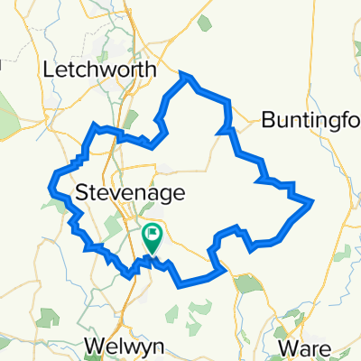
The route starts from Knebworth Station and then runs clockwise to the east of Stevenage, on quiet, gently undulating roads around the East Hertfordshire Plateau. (You could as easily start from Stevenage, if you don’t mind the town traffic!). It crosses the River Rib and (Roman) Ermine Street at Buntingford and beyond that follows the River Quin south to Braughing, before turning West to return to Knebworth via Stapleford. This was another part of territory of the Catuvellauni until the Romans arrived and turned their oppidum at Braughing into a town which for a while vied in importance with St Albans. There is little t o see of it now; and the varied landscape is a microcosm of the changes in the agricultural and village landscape since Medieval times.
Zooming In
Highlights are:
The post mill in Cromer. You won’t see many of those!
Locations used in the 2005 film of 'Hitchhiker's Guide to the Galaxy, Arthur Dent's house and the local pub, where he is drinking when the planet is blown up.
A hamlet named 'Nasty'. You can guarantee that name wasn't invented by estate agents. (There is also a hill called Bummers!)
Buntingford, where the High Street is a Roman Road and (it is claimed) became England’s first turnpike.
A cornucopia of ancient and listed buildings. The churches at Walkern, St Wydial, Buntingford and Braughing are rated 'Grade 1' and (catering to my own religion), Braughing has a Grade 2* listed boozer, the Brown Bear
And gratuitous oddities.
On the blog there are detailed notes on waypoints and things to see ,which I hope will be more entertaining than the links to dry Wikipedia articles dredged up as POI’s by the mapping apps’ software robots. If your mapping app has not imported these, use this link to go directly to the blog post of the route. This cannot give you the exact location for each waypoint but it many cases you won’t need it and at least the information will be up to date!
Link: Pootler Route
Zooming Out
This is chalk country but that is usually only seen where the plateau has been dissected by a river. Elsewhere it is covered, mostly by boulder clay, first deposited and then diced, sliced and scoured through aeons of glaciation and erosion. In the valleys, more fertile loamy soils facilitate intensive arable farming.
In the Iron Age, the Belgic 'Catuvellauni' tribe took over the area from the Trinovantes and built an 'Oppida' or stronghold at Braughing, which is on this route and which later developed into a lively, commercial Roman settlement covering some 15 ha. To picture it, think of a settlement of timber houses built around a few streets, with a few brick or stone public buildings such as a baths. Only a little further south, at Puckridge, was the intersection of Stane Street, Ermine Street and other major roads, all part of the system that started with the Appian Way in Rome and revolutionised European transport. There is nothing to see now, but Braughing is regarded as one of the most important archaeological sites in Hertfordshire. The current pattern of settlement and cultivation began with the Saxons. One of the early tribes were known as the Brahingas who gave their name to Braughing. The villages are stuffed full of Listed Buildings and old churches. Some of the latter have Saxon origins traces of the latter See Link: Listed Buildings in Herts
Beyond that the main legacy is in the faded patterns of ditches, fields and tracks in what experts define as 'ancient' countryside with villages, isolated farms and hamlets, narrow lanes and very old hedgerows; a pattern of settlement thought to have been created by 'assarting', or the clearance of forests, in the 12th & 13th century. Forests apart, the area has always been relatively densely settled.
Braughing’s decline as an administrative centre compared to St Albans started very early on, and in the Medieval era it must also have been eclipsed by places like Ware, with its access to the navigable River Lea. Like most places, the agricultural population and economy would have grown in the centuries immediately after the Norman Conquest. The 1300’s brought a sharp reversal as the climate cooled and crop failures were followed by the Black Death at a time when England was almost constantly at war. If there is once century to avoid on your time travels, this might be it! There are several abandoned villages hereabouts. Recovery took a century or more during which labour shortages led to rising incomes and a shift towards less labour-intensive pastoral farming, mainly sheep. People started investing in the their property and many of the oldest houses that you see today were the result of this ‘Great Rebuilding’.
On the blog you will also find posts on the rich and complicated human and topographical history of the area as a whole, ranging from the early occupation, the changing agricultural landscape, the geomorphology of the chalk country, the buildings and anything else that moves me.
At Link: Pootler / Other Stuff
Route Tips
If your app provides notes on the road surfaces etc. keep in mind that they are automatically generated and only as good as the underlying mapping.This is a road tour and I have never had a problem on it.
- -:--
- Duration
- 60.2 km
- Distance
- 426 m
- Ascent
- 432 m
- Descent
- ---
- Avg. speed
- 146 m
- Max. altitude

Route quality
Waytypes & surfaces along the route
Waytypes
Quiet road
18.4 km
(31 %)
Busy road
18.3 km
(30 %)
Surfaces
Paved
20.9 km
(35 %)
Unpaved
0.2 km
(<1 %)
Asphalt
20.9 km
(35 %)
Gravel
0.2 km
(<1 %)
Undefined
39.2 km
(65 %)
Continue with Bikemap
Use, edit, or download this cycling route
You would like to ride Nasty, Romans and Vogons. or customize it for your own trip? Here is what you can do with this Bikemap route:
Free features
- Save this route as favorite or in collections
- Copy & plan your own version of this route
- Sync your route with Garmin or Wahoo
Premium features
Free trial for 3 days, or one-time payment. More about Bikemap Premium.
- Navigate this route on iOS & Android
- Export a GPX / KML file of this route
- Create your custom printout (try it for free)
- Download this route for offline navigation
Discover more Premium features.
Get Bikemap PremiumFrom our community
Other popular routes starting in Knebworth
 Bragbury end to Bragbury End big circuit with punctures to boot!
- Distance
- 43.9 km
- Ascent
- 441 m
- Descent
- 442 m
- Location
- Knebworth, England, United Kingdom
 Nasty, Romans and Vogons.
- Distance
- 60.2 km
- Ascent
- 426 m
- Descent
- 432 m
- Location
- Knebworth, England, United Kingdom
 test1
test1- Distance
- 2.7 km
- Ascent
- 12 m
- Descent
- 34 m
- Location
- Knebworth, England, United Kingdom
 21 Hidden Hertfordshire
- Distance
- 59.5 km
- Ascent
- 394 m
- Descent
- 394 m
- Location
- Knebworth, England, United Kingdom
 Bragbury End to Baldock circuit
- Distance
- 35.5 km
- Ascent
- 436 m
- Descent
- 436 m
- Location
- Knebworth, England, United Kingdom
 Sherrards wood loop
- Distance
- 50 km
- Ascent
- 435 m
- Descent
- 436 m
- Location
- Knebworth, England, United Kingdom
 Tour de Stevenage
- Distance
- 62.3 km
- Ascent
- 547 m
- Descent
- 548 m
- Location
- Knebworth, England, United Kingdom
 Aston Lane to Aston lane via fields, tracks, Brockett Hall Golf Course and nature reserve. nice.
- Distance
- 32.4 km
- Ascent
- 371 m
- Descent
- 369 m
- Location
- Knebworth, England, United Kingdom
Open it in the app