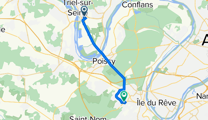
35 Sente des Châtelets, Triel-sur-Seine à 24 Chemin du Buisson Guérin, Mareil-Marly
A cycling route starting in Triel-sur-Seine, Île-de-France Region, France.
Overview
About this route
- 34 min
- Duration
- 12.9 km
- Distance
- 166 m
- Ascent
- 68 m
- Descent
- 22.5 km/h
- Avg. speed
- 109 m
- Max. altitude
Continue with Bikemap
Use, edit, or download this cycling route
You would like to ride 35 Sente des Châtelets, Triel-sur-Seine à 24 Chemin du Buisson Guérin, Mareil-Marly or customize it for your own trip? Here is what you can do with this Bikemap route:
Free features
- Save this route as favorite or in collections
- Copy & plan your own version of this route
- Sync your route with Garmin or Wahoo
Premium features
Free trial for 3 days, or one-time payment. More about Bikemap Premium.
- Navigate this route on iOS & Android
- Export a GPX / KML file of this route
- Create your custom printout (try it for free)
- Download this route for offline navigation
Discover more Premium features.
Get Bikemap PremiumFrom our community
Other popular routes starting in Triel-sur-Seine
- 35 Sente des Châtelets, Triel-sur-Seine à 24 Chemin du Buisson Guérin, Mareil-Marly
- Distance
- 12.9 km
- Ascent
- 166 m
- Descent
- 68 m
- Location
- Triel-sur-Seine, Île-de-France Region, France
- tronçon 3
- Distance
- 62.6 km
- Ascent
- 271 m
- Descent
- 268 m
- Location
- Triel-sur-Seine, Île-de-France Region, France
- day 3.2 (website)
- Distance
- 55.1 km
- Ascent
- 589 m
- Descent
- 576 m
- Location
- Triel-sur-Seine, Île-de-France Region, France
- Bois de l'Hautil
- Distance
- 11.9 km
- Ascent
- 264 m
- Descent
- 264 m
- Location
- Triel-sur-Seine, Île-de-France Region, France
- fff
- Distance
- 2.8 km
- Ascent
- 145 m
- Descent
- 0 m
- Location
- Triel-sur-Seine, Île-de-France Region, France
- De Quai Auguste Roy à Quai Auguste Roy
- Distance
- 7.2 km
- Ascent
- 212 m
- Descent
- 212 m
- Location
- Triel-sur-Seine, Île-de-France Region, France
- De Jean Mermoz, Vernouillet à Rue Noël Gilles 11bis, Vernouillet
- Distance
- 65.6 km
- Ascent
- 523 m
- Descent
- 502 m
- Location
- Triel-sur-Seine, Île-de-France Region, France
- erster tag zweite etappe
- Distance
- 41 km
- Ascent
- 212 m
- Descent
- 208 m
- Location
- Triel-sur-Seine, Île-de-France Region, France
Open it in the app