

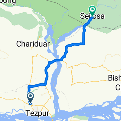
National Highway 15, Tezpur to National Highway 15, Goroi Mari Borpukhuri
A cycling route starting in Tezpur, Assam, India.
Overview
About this route
- 54 min
- Duration
- 6.6 km
- Distance
- 108 m
- Ascent
- 118 m
- Descent
- 7.3 km/h
- Avg. speed
- 92 m
- Max. altitude

Route quality
Waytypes & surfaces along the route
Waytypes
Cycleway
6.2 km
(94 %)
Access road
0.4 km
(6 %)
Continue with Bikemap
Use, edit, or download this cycling route
You would like to ride National Highway 15, Tezpur to National Highway 15, Goroi Mari Borpukhuri or customize it for your own trip? Here is what you can do with this Bikemap route:
Free features
- Save this route as favorite or in collections
- Copy & plan your own version of this route
- Sync your route with Garmin or Wahoo
Premium features
Free trial for 3 days, or one-time payment. More about Bikemap Premium.
- Navigate this route on iOS & Android
- Export a GPX / KML file of this route
- Create your custom printout (try it for free)
- Download this route for offline navigation
Discover more Premium features.
Get Bikemap PremiumFrom our community
Other popular routes starting in Tezpur
 Tezpur to Itakhola-Seijusa Road
- Distance
- 52.7 km
- Ascent
- 358 m
- Descent
- 270 m
- Location
- Tezpur, Assam, India
 Tezpur - Tawang
- Distance
- 331.6 km
- Ascent
- 6,434 m
- Descent
- 3,688 m
- Location
- Tezpur, Assam, India
 trishul dhari
- Distance
- 42.6 km
- Ascent
- 432 m
- Descent
- 368 m
- Location
- Tezpur, Assam, India
 Route from Ushanagar, Tezpur
- Distance
- 45.5 km
- Ascent
- 474 m
- Descent
- 476 m
- Location
- Tezpur, Assam, India
 Mahatma Gandhi Road, Tezpur to MR32+VF4, Tezpur
- Distance
- 5 km
- Ascent
- 71 m
- Descent
- 76 m
- Location
- Tezpur, Assam, India
 Route to PQG9+73P, Tezpur
- Distance
- 42.5 km
- Ascent
- 367 m
- Descent
- 343 m
- Location
- Tezpur, Assam, India
 National Highway 15, Tezpur to National Highway 15, Goroi Mari Borpukhuri
- Distance
- 6.6 km
- Ascent
- 108 m
- Descent
- 118 m
- Location
- Tezpur, Assam, India
 grind yourself (my dream to complete it).
- Distance
- 246.1 km
- Ascent
- 5,825 m
- Descent
- 5,823 m
- Location
- Tezpur, Assam, India
Open it in the app