

06-rest
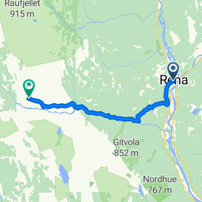
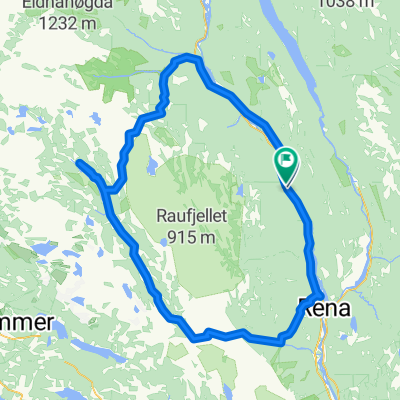
A cycling route starting in Rena, Hedmark, Norway.
Overview
About this route
- -:--
- Duration
- 769.3 km
- Distance
- 7,108 m
- Ascent
- 7,341 m
- Descent
- ---
- Avg. speed
- 474 m
- Max. altitude

Route quality
Waytypes & surfaces along the route
Waytypes
Cycleway
184.6 km
(24 %)
Quiet road
92.3 km
(12 %)
Surfaces
Paved
507.8 km
(66 %)
Unpaved
84.6 km
(11 %)
Asphalt
500.1 km
(65 %)
Gravel
53.9 km
(7 %)
Continue with Bikemap
Use, edit, or download this cycling route
You would like to ride 06-rest or customize it for your own trip? Here is what you can do with this Bikemap route:
Free features
- Save this route as favorite or in collections
- Copy & plan your own version of this route
- Split it into stages to create a multi-day tour
- Sync your route with Garmin or Wahoo
Premium features
Free trial for 3 days, or one-time payment. More about Bikemap Premium.
- Navigate this route on iOS & Android
- Export a GPX / KML file of this route
- Create your custom printout (try it for free)
- Download this route for offline navigation
Discover more Premium features.
Get Bikemap PremiumFrom our community
Other popular routes starting in Rena
 Turbirken 86 km
- Distance
- 85 km
- Ascent
- 1,237 m
- Descent
- 1,143 m
- Location
- Rena, Hedmark, Norway
 Birkebeienrrittet 2010
- Distance
- 91.1 km
- Ascent
- 1,190 m
- Descent
- 1,147 m
- Location
- Rena, Hedmark, Norway
 Landeveisbirken CLONED FROM ROUTE 1034069
- Distance
- 172 km
- Ascent
- 943 m
- Descent
- 925 m
- Location
- Rena, Hedmark, Norway
 20 km testride Rena
- Distance
- 20 km
- Ascent
- 0 m
- Descent
- 0 m
- Location
- Rena, Hedmark, Norway

 Landeveisbirken CLONED FROM ROUTE 1034069
- Distance
- 172.1 km
- Ascent
- 933 m
- Descent
- 915 m
- Location
- Rena, Hedmark, Norway
 Birken 19
- Distance
- 25.8 km
- Ascent
- 554 m
- Descent
- 180 m
- Location
- Rena, Hedmark, Norway
 Langtur Hytta
- Distance
- 135.9 km
- Ascent
- 0 m
- Descent
- 0 m
- Location
- Rena, Hedmark, Norway
Open it in the app