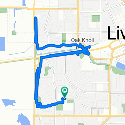
Collier Canyon Loop
A cycling route starting in Livermore, California, United States of America.
Overview
About this route
- 1 h 10 min
- Duration
- 23.1 km
- Distance
- 180 m
- Ascent
- 180 m
- Descent
- 19.8 km/h
- Avg. speed
- 249 m
- Avg. speed
Route photos
Route quality
Waytypes & surfaces along the route
Waytypes
Road
13.5 km
(58 %)
Quiet road
5.2 km
(23 %)
Surfaces
Paved
3.6 km
(16 %)
Asphalt
3.6 km
(15 %)
Concrete
0.1 km
(<1 %)
Undefined
19.5 km
(84 %)
Continue with Bikemap
Use, edit, or download this cycling route
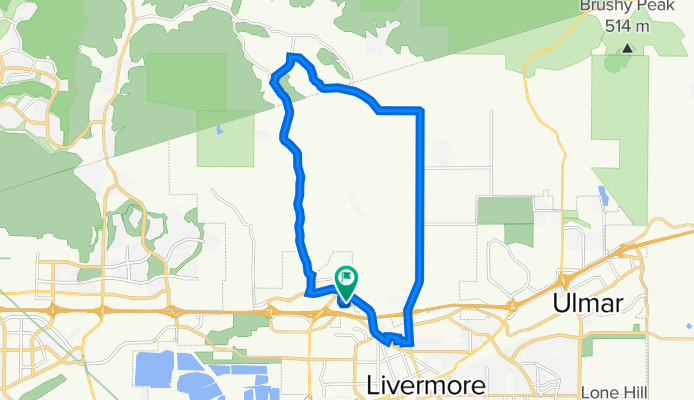
You would like to ride Collier Canyon Loop or customize it for your own trip? Here is what you can do with this Bikemap route:
Free features
- Save this route as favorite or in collections
- Copy & plan your own version of this route
- Sync your route with Garmin or Wahoo
Premium features
Free trial for 3 days, or one-time payment. More about Bikemap Premium.
- Navigate this route on iOS & Android
- Export a GPX / KML file of this route
- Create your custom printout (try it for free)
- Download this route for offline navigation
Discover more Premium features.
Get Bikemap PremiumFrom our community
Other popular routes starting in Livermore
- 35 Mile Training Route
- Distance
- 57.4 km
- Ascent
- 155 m
- Descent
- 154 m
- Location
- Livermore, California, United States of America
- Thursday Ride
- Distance
- 35.4 km
- Ascent
- 133 m
- Descent
- 135 m
- Location
- Livermore, California, United States of America
- Del Valle from Dam
- Distance
- 11.9 km
- Ascent
- 333 m
- Descent
- 333 m
- Location
- Livermore, California, United States of America
- OYJ Mines Road (H)
- Distance
- 89.2 km
- Ascent
- 947 m
- Descent
- 947 m
- Location
- Livermore, California, United States of America
- Relaxed route in Livermore
- Distance
- 33.9 km
- Ascent
- 763 m
- Descent
- 764 m
- Location
- Livermore, California, United States of America
- Morgan Territory Loop
- Distance
- 71.7 km
- Ascent
- 749 m
- Descent
- 752 m
- Location
- Livermore, California, United States of America
- Long bike tour through Livermore
- Distance
- 33.2 km
- Ascent
- 215 m
- Descent
- 215 m
- Location
- Livermore, California, United States of America
- Wente Vineyards
- Distance
- 26.8 km
- Ascent
- 351 m
- Descent
- 359 m
- Location
- Livermore, California, United States of America