

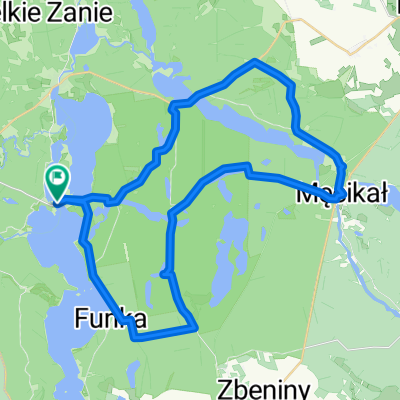
Plac Jagielloński-Niezychowice
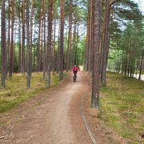
A cycling route starting in Chojnice, Pomeranian Voivodeship, Poland.
Overview
About this route
- 24 min
- Duration
- 6.7 km
- Distance
- 54 m
- Ascent
- 59 m
- Descent
- 17.1 km/h
- Avg. speed
- 177 m
- Max. altitude

Route quality
Waytypes & surfaces along the route
Waytypes
Path
2.5 km
(37 %)
Quiet road
2.2 km
(32 %)
Surfaces
Paved
0.5 km
(8 %)
Asphalt
0.5 km
(8 %)
Undefined
6.2 km
(92 %)
Continue with Bikemap
Use, edit, or download this cycling route
You would like to ride Plac Jagielloński-Niezychowice or customize it for your own trip? Here is what you can do with this Bikemap route:
Free features
- Save this route as favorite or in collections
- Copy & plan your own version of this route
- Sync your route with Garmin or Wahoo
Premium features
Free trial for 3 days, or one-time payment. More about Bikemap Premium.
- Navigate this route on iOS & Android
- Export a GPX / KML file of this route
- Create your custom printout (try it for free)
- Download this route for offline navigation
Discover more Premium features.
Get Bikemap PremiumFrom our community
Other popular routes starting in Chojnice
 Dąb Bartek
- Distance
- 34.5 km
- Ascent
- 155 m
- Descent
- 158 m
- Location
- Chojnice, Pomeranian Voivodeship, Poland
 Chojnice, Chojnice do Łąkowa, Charzykowy
- Distance
- 43.4 km
- Ascent
- 706 m
- Descent
- 749 m
- Location
- Chojnice, Pomeranian Voivodeship, Poland
 Charzykowy Tour
- Distance
- 38 km
- Ascent
- 180 m
- Descent
- 182 m
- Location
- Chojnice, Pomeranian Voivodeship, Poland
 Ósemka Charzykowska
- Distance
- 49.6 km
- Ascent
- 251 m
- Descent
- 251 m
- Location
- Chojnice, Pomeranian Voivodeship, Poland
 Chociński Młyn Bachorze Ch.M.
- Distance
- 13.4 km
- Ascent
- 107 m
- Descent
- 141 m
- Location
- Chojnice, Pomeranian Voivodeship, Poland
 Wyprawa nr 2
- Distance
- 49.9 km
- Ascent
- 163 m
- Descent
- 164 m
- Location
- Chojnice, Pomeranian Voivodeship, Poland
 po Parku Narodowym "Bory Tucholskie"
- Distance
- 31.9 km
- Ascent
- 155 m
- Descent
- 155 m
- Location
- Chojnice, Pomeranian Voivodeship, Poland
 Chojnicka, Małe Swornegacie do Chojnicka, Małe Swornegacie
- Distance
- 42.6 km
- Ascent
- 706 m
- Descent
- 706 m
- Location
- Chojnice, Pomeranian Voivodeship, Poland
Open it in the app