

Rundweg Naab-Donau-Regen-Schwarzach
A cycling route starting in Kallmünz, Bavaria, Germany.
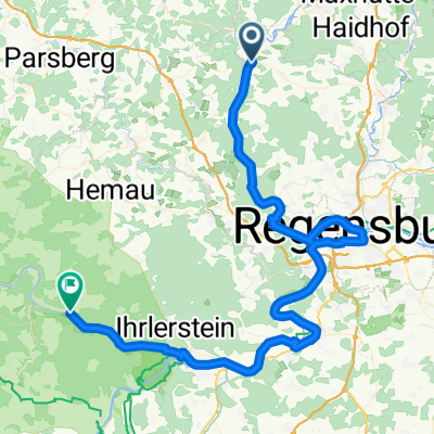
Overview
About this route
This route can be practically started anywhere! It runs along beautiful river landscapes and is well signposted. You start and end at the Naabtalradweg. All bike paths along Naab-Danube-Regen-Schwarzach are well marked! The transition from Cham to Schönthal at the Schwarzach is a bit difficult but doable! The Eixendorfer Reservoir is a remarkable and beautiful point of the hike. From Schwarzenburg, you can also make a detour into the Oberpfalz Lakes region! Or you can start from there! Beautiful swimming lakes and camping sites can be found there!
- -:--
- Duration
- 188.3 km
- Distance
- 385 m
- Ascent
- 361 m
- Descent
- ---
- Avg. speed
- ---
- Max. altitude
Route highlights
Points of interest along the route
Point of interest after 0.2 km
Startpunkt Gaststätte Eicher Berg,Fam. Graf
Continue with Bikemap
Use, edit, or download this cycling route
You would like to ride Rundweg Naab-Donau-Regen-Schwarzach or customize it for your own trip? Here is what you can do with this Bikemap route:
Free features
- Save this route as favorite or in collections
- Copy & plan your own version of this route
- Split it into stages to create a multi-day tour
- Sync your route with Garmin or Wahoo
Premium features
Free trial for 3 days, or one-time payment. More about Bikemap Premium.
- Navigate this route on iOS & Android
- Export a GPX / KML file of this route
- Create your custom printout (try it for free)
- Download this route for offline navigation
Discover more Premium features.
Get Bikemap PremiumFrom our community
Other popular routes starting in Kallmünz
 Kallmünz - Regensburg
- Distance
- 53.2 km
- Ascent
- 321 m
- Descent
- 321 m
- Location
- Kallmünz, Bavaria, Germany
 PVDA-Tag2
- Distance
- 79.8 km
- Ascent
- 512 m
- Descent
- 513 m
- Location
- Kallmünz, Bavaria, Germany
 Hohenfels/Beratzhausen/Laaber
- Distance
- 70.7 km
- Ascent
- 516 m
- Descent
- 557 m
- Location
- Kallmünz, Bavaria, Germany
 Naabfahrt Kallmünz-Burglengenfeld
- Distance
- 9.6 km
- Ascent
- 106 m
- Descent
- 100 m
- Location
- Kallmünz, Bavaria, Germany
 Kallmünz bis Regensburg
- Distance
- 33.5 km
- Ascent
- 412 m
- Descent
- 378 m
- Location
- Kallmünz, Bavaria, Germany
 Kallmünz - Regensburg über Pettendorf
- Distance
- 27.1 km
- Ascent
- 243 m
- Descent
- 238 m
- Location
- Kallmünz, Bavaria, Germany
 Rundweg Naab-Donau-Regen-Schwarzach
- Distance
- 188.3 km
- Ascent
- 385 m
- Descent
- 361 m
- Location
- Kallmünz, Bavaria, Germany
 W-P3a: Kallmünz - Paulushofen 65,1km 530hm
- Distance
- 65.1 km
- Ascent
- 530 m
- Descent
- 365 m
- Location
- Kallmünz, Bavaria, Germany
Open it in the app