

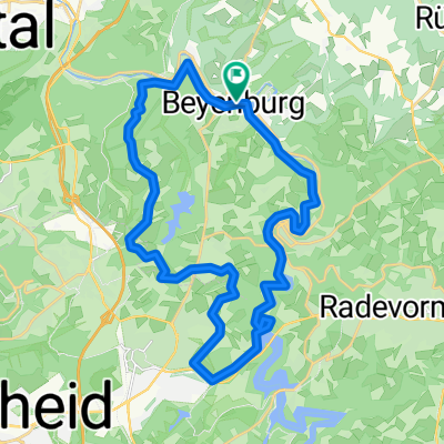
Wuppertal Langerfeld, Wetter, Ruhrtalradweg bis Kemnader See, Sprockhövel, Schwelm, Wuppertal Langerfeld
A cycling route starting in Schwelm, North Rhine-Westphalia, Germany.
Overview
About this route
Mit Rennrad fahrbar, jedoch Einschränkungen auf dem Ruhrtalradweg (Feinschotter, Kopfsteinpflasterstücke und recht viel Fußgängerverkehr, besonders bei Schönwetter und an Sonntagen). Öffnungszeiten der Fähre Hardenstein bitte dem Internet entnehmen und ausserhalb der Öffnungszeiten die ausgeschilderte Umgehung fahren.
- -:--
- Duration
- 56.8 km
- Distance
- 542 m
- Ascent
- 535 m
- Descent
- ---
- Avg. speed
- 288 m
- Max. altitude
Route quality
Waytypes & surfaces along the route
Waytypes
Busy road
31.9 km
(56 %)
Path
7.7 km
(13 %)
Surfaces
Paved
52 km
(92 %)
Unpaved
1.9 km
(3 %)
Asphalt
48.5 km
(85 %)
Paving stones
2.8 km
(5 %)
Continue with Bikemap
Use, edit, or download this cycling route
You would like to ride Wuppertal Langerfeld, Wetter, Ruhrtalradweg bis Kemnader See, Sprockhövel, Schwelm, Wuppertal Langerfeld or customize it for your own trip? Here is what you can do with this Bikemap route:
Free features
- Save this route as favorite or in collections
- Copy & plan your own version of this route
- Sync your route with Garmin or Wahoo
Premium features
Free trial for 3 days, or one-time payment. More about Bikemap Premium.
- Navigate this route on iOS & Android
- Export a GPX / KML file of this route
- Create your custom printout (try it for free)
- Download this route for offline navigation
Discover more Premium features.
Get Bikemap PremiumFrom our community
Other popular routes starting in Schwelm
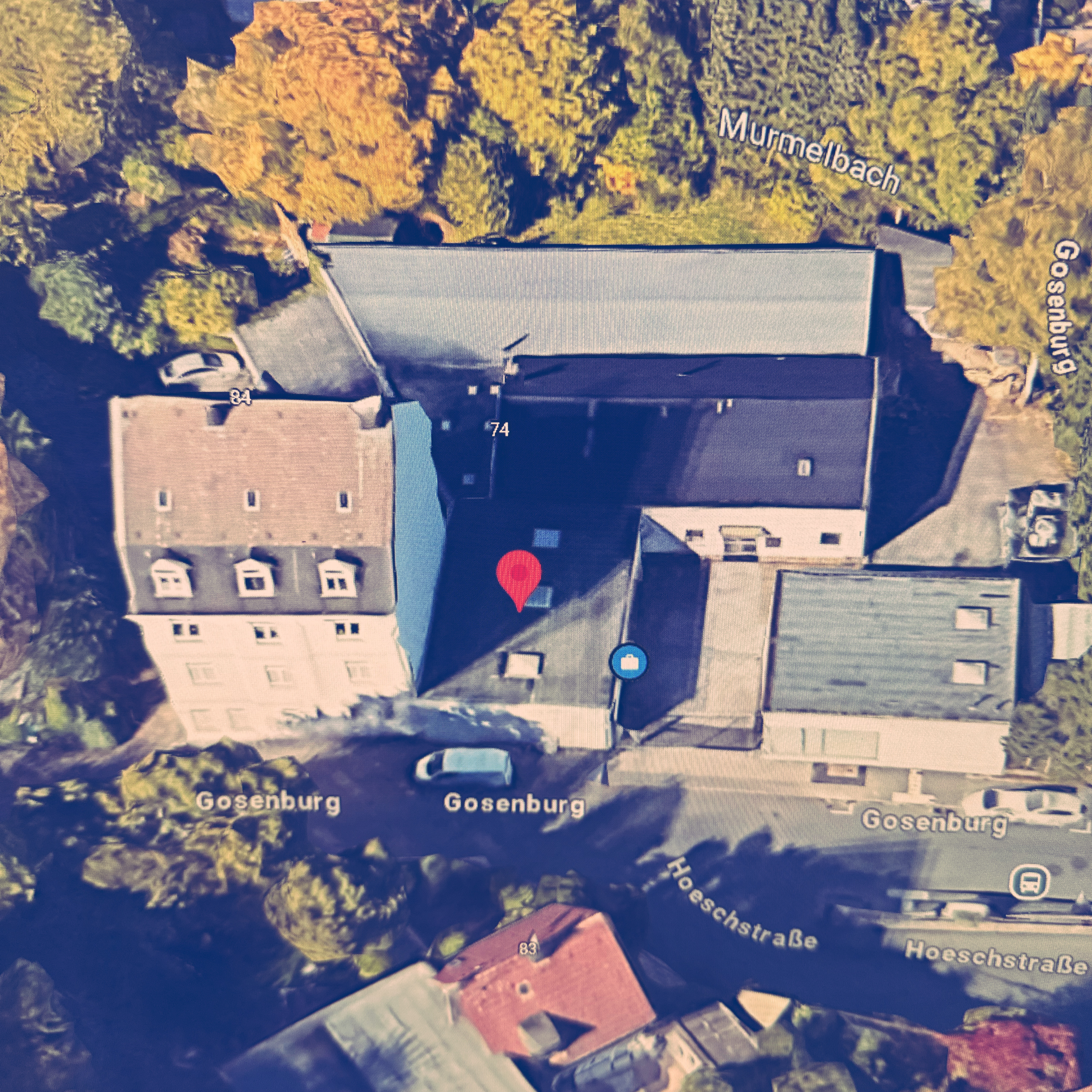 Henkelsstraße, Wuppertal nach Gosenburg, Wuppertal
- Distance
- 3.1 km
- Ascent
- 38 m
- Descent
- 57 m
- Location
- Schwelm, North Rhine-Westphalia, Germany
 Werktagsrunde
- Distance
- 47.6 km
- Ascent
- 639 m
- Descent
- 623 m
- Location
- Schwelm, North Rhine-Westphalia, Germany
 RTF Schwelm 2009
- Distance
- 108.7 km
- Ascent
- 1,256 m
- Descent
- 1,229 m
- Location
- Schwelm, North Rhine-Westphalia, Germany
 Brunnenstraße, Schwelm nach Brunnenstraße, Schwelm
- Distance
- 33.5 km
- Ascent
- 439 m
- Descent
- 440 m
- Location
- Schwelm, North Rhine-Westphalia, Germany
 Rundtour Bergischer Panoramaweg, Start in Schwelm
- Distance
- 73.6 km
- Ascent
- 452 m
- Descent
- 455 m
- Location
- Schwelm, North Rhine-Westphalia, Germany
 Feierabend Route über Löhrerlen, Schee, Hasslinghausen, Gevelsberg
- Distance
- 23.3 km
- Ascent
- 156 m
- Descent
- 155 m
- Location
- Schwelm, North Rhine-Westphalia, Germany
 Standardrunde von Frank und Frank
- Distance
- 27.5 km
- Ascent
- 531 m
- Descent
- 515 m
- Location
- Schwelm, North Rhine-Westphalia, Germany
 Trainingsstrecke 2
- Distance
- 42.4 km
- Ascent
- 383 m
- Descent
- 383 m
- Location
- Schwelm, North Rhine-Westphalia, Germany
Open it in the app