

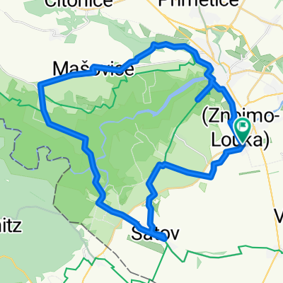
K Náhonu 2946/13, Znojmo to Dyjákovičky
A cycling route starting in Dobšice, South Moravian, Czechia.
Overview
About this route
- 37 min
- Duration
- 10.7 km
- Distance
- 96 m
- Ascent
- 91 m
- Descent
- 17.3 km/h
- Avg. speed
- 255 m
- Max. altitude
Route quality
Waytypes & surfaces along the route
Waytypes
Road
7.3 km
(68 %)
Quiet road
2.7 km
(25 %)
Surfaces
Paved
0.2 km
(2 %)
Asphalt
0.2 km
(2 %)
Undefined
10.5 km
(98 %)
Continue with Bikemap
Use, edit, or download this cycling route
You would like to ride K Náhonu 2946/13, Znojmo to Dyjákovičky or customize it for your own trip? Here is what you can do with this Bikemap route:
Free features
- Save this route as favorite or in collections
- Copy & plan your own version of this route
- Sync your route with Garmin or Wahoo
Premium features
Free trial for 3 days, or one-time payment. More about Bikemap Premium.
- Navigate this route on iOS & Android
- Export a GPX / KML file of this route
- Create your custom printout (try it for free)
- Download this route for offline navigation
Discover more Premium features.
Get Bikemap PremiumFrom our community
Other popular routes starting in Dobšice
 Seesfeld bez seesfeldu
- Distance
- 20.6 km
- Ascent
- 232 m
- Descent
- 226 m
- Location
- Dobšice, South Moravian, Czechia
 Nový Šaldorf
- Distance
- 45.9 km
- Ascent
- 294 m
- Descent
- 294 m
- Location
- Dobšice, South Moravian, Czechia
 Laa-Retz
- Distance
- 82.1 km
- Ascent
- 215 m
- Descent
- 214 m
- Location
- Dobšice, South Moravian, Czechia
 Znojmo_Vranov_Znojmo_63_940
- Distance
- 62.2 km
- Ascent
- 1,068 m
- Descent
- 1,070 m
- Location
- Dobšice, South Moravian, Czechia
 Znojmo 9.8.2009
- Distance
- 39.9 km
- Ascent
- 347 m
- Descent
- 347 m
- Location
- Dobšice, South Moravian, Czechia
 Giro di Neu Schallersdorf
- Distance
- 36.9 km
- Ascent
- 293 m
- Descent
- 292 m
- Location
- Dobšice, South Moravian, Czechia
 Nový Šaldorf- Hardegg-Vranov-Nový Šaldorf
- Distance
- 70.4 km
- Ascent
- 835 m
- Descent
- 835 m
- Location
- Dobšice, South Moravian, Czechia
 Nový Šaldorf
- Distance
- 33.7 km
- Ascent
- 472 m
- Descent
- 472 m
- Location
- Dobšice, South Moravian, Czechia
Open it in the app