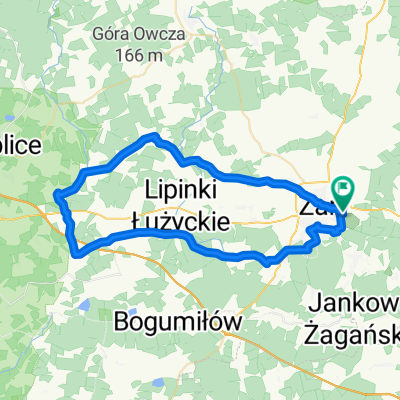
Rezerwat ŻURAWIE BAGNO
- 102.5 km
- 239 m
- 236 m
- Żary, Lubusz Voivodship, Poland
👑 Korona Gór Powiatu Żarskiego 👑
A cycling route starting in Żary, Lubusz Voivodship, Poland.
Overview
created this 3 years ago
Part of
4 stages


Route quality
Quiet road
20 km
(26 %)
Road
18.5 km
(24 %)
Paved
32.4 km
(42 %)
Unpaved
30.8 km
(40 %)
Asphalt
30.1 km
(39 %)
Gravel
20.8 km
(27 %)
Route highlights

KRZYŻ

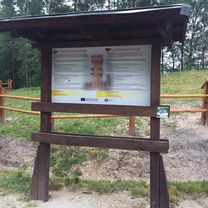
TABLICA INFORMACYJNA

POŻAROWA (182,8 m n.p.m.) GMINA TRZEBIEL

GEOPARK

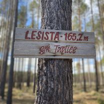
ŁĘKNICKA GÓRA (165,2 m n.p.m.) MIASTO ŁĘKNICA

PARK KRAJOBRAZOWY ŁUK MUŻAKOWA

CHEŁMICA

TARCZA
Continue with Bikemap
You would like to ride 👑 Korona Gór Powiatu Żarskiego 👑 7️⃣3️⃣ 👑 TRASA 6 👑 or customize it for your own trip? Here is what you can do with this Bikemap route:
Free trial for 3 days, or one-time payment. More about Bikemap Premium.
Discover more Premium features.
Get Bikemap PremiumFrom our community
Open it in the app