

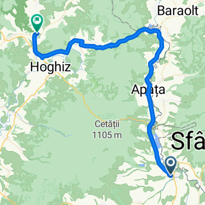
Transilvania Epoque MTB Feldioara 49 km Feldioara - Rotbav - L. Rotbav - Maierus - Aita Mare - Feldioara (ADE 73)
A cycling route starting in Feldioara, Brașov County, Romania.
Overview
About this route
*** 2022 May. Route length: 49 km. Offroad / gravel road: 16 km; asphalt / concrete slabs: 33 km
*** description, map & photos by FB page "Green trails MTB outdoor-fun"
*** Duration: 7h30m in my case, moderate pace; this duration included enough breaks to admire the landscapes, photos, visiting some attractions on the route and a lunch break at a location in Maierus. Bike type: MTB XC hardtail (not an E-bike). The photos were taken on the uploaded route but may belong to different periods / seasons.
*** My favs: --- visiting the charming Feldioara fortress (km 0,3); the road along the Rotbav lake between km 9,8 - 12,7 and the one near the Olt river bank between km 3,9 - 4,8 and between km 17,7 - 19,4.
*** On the route: the fortified evangelical church in Feldioara (km 0); the Feldioara fortress - Marienburg (km 0,3); the fortified evangelical church in Rotbav (km 6,5); the fortified evangelical church in Maierus (km 15,8); the fortified evangelical church in Apata (km 25,4); the fortified Unitarian church in Aita Mare (km 28,8); the Gothic-style Roman Catholic church in Haghig (km 45; the registered map passes by the base of the hill on which the church stands); the fortified Reformed church in Haghig (km 45,4).
*** For the part of the tour that takes place on asphalt - I found, in most cases, solutions to avoid heavy traffic - using either sections next to the road (for example - additional space next to the traffic lane, green space; or bike lanes as much as they existed), or streets with less traffic - which for me was safe enough.
After just a few dozen meters from the start of this bike trip, I visited the beautiful Feldioara fortress - Marienburg, entering at km 0.7 on the gravel road between the railway and the Olt river which led me into the village of Rotbav. After re-entering offroad at km 9.1, I went about 700 meters on a section that can get a bit messy after rain, after which followed the beautiful gravel road that climbs several times on the dike and winds its way between the lake and the Olt.
After strolling through the village of Maierus, there was an excursion along the bank of the Olt, this time the road became grassy between km 19.3 - 22.3 which runs approximately 400 meters from km 21.7 on the little dike located to the left of the stream, and after crossing the railway bridge (on the section next to the metal bridge; I paid special attention here as the railway is trafficked) I continued for about 200 meters on the dike to the right of the stream, entering at km 22.3 on asphalt (and from here until the end of the tour there was only one small excursion offroad, between km 28.9 - 29.4). The road continues undulating until the village of Haghig and after crossing the Olt and the railway, I returned with a climb of about 600 meters towards the place where I began my bike trip.
Have fun :)
- -:--
- Duration
- 49.1 km
- Distance
- 175 m
- Ascent
- 175 m
- Descent
- ---
- Avg. speed
- 515 m
- Max. altitude

Route photos
\"")
\"")
\"")
\"")
\"")
\"")
\"")
\"")
Continue with Bikemap
Use, edit, or download this cycling route
You would like to ride Transilvania Epoque MTB Feldioara 49 km Feldioara - Rotbav - L. Rotbav - Maierus - Aita Mare - Feldioara (ADE 73) or customize it for your own trip? Here is what you can do with this Bikemap route:
Free features
- Save this route as favorite or in collections
- Copy & plan your own version of this route
- Sync your route with Garmin or Wahoo
Premium features
Free trial for 3 days, or one-time payment. More about Bikemap Premium.
- Navigate this route on iOS & Android
- Export a GPX / KML file of this route
- Create your custom printout (try it for free)
- Download this route for offline navigation
Discover more Premium features.
Get Bikemap PremiumFrom our community
Other popular routes starting in Feldioara
 Feldioara to Strada Principală 1, Vulcan
- Distance
- 44.3 km
- Ascent
- 132 m
- Descent
- 46 m
- Location
- Feldioara, Brașov County, Romania
 Transilvania Epoque MTB Feldioara 49 km Feldioara - Rotbav - L. Rotbav - Maierus - Aita Mare - Feldioara (ADE 73)
- Distance
- 49.1 km
- Ascent
- 175 m
- Descent
- 175 m
- Location
- Feldioara, Brașov County, Romania
 feldioara bod crizbav
- Distance
- 31.4 km
- Ascent
- 542 m
- Descent
- 46 m
- Location
- Feldioara, Brașov County, Romania
 Cicla #xx Test2 Feldioara-Odorjeiu-MiercCiuc-SfGhe-Feld
- Distance
- 230.1 km
- Ascent
- 1,107 m
- Descent
- 1,106 m
- Location
- Feldioara, Brașov County, Romania
 feld hom
- Distance
- 60.1 km
- Ascent
- 170 m
- Descent
- 214 m
- Location
- Feldioara, Brașov County, Romania
 Feldioara Crizbav
- Distance
- 13.3 km
- Ascent
- 104 m
- Descent
- 40 m
- Location
- Feldioara, Brașov County, Romania
 nr 1 - Strada Mihai Eminescu 69, Feldioara to Strada Mihai Eminescu 69, Feldioara
- Distance
- 73.5 km
- Ascent
- 1,112 m
- Descent
- 1,110 m
- Location
- Feldioara, Brașov County, Romania
 112324556
- Distance
- 42.9 km
- Ascent
- 300 m
- Descent
- 344 m
- Location
- Feldioara, Brașov County, Romania
Open it in the app