

CYCLING THE RHINE: Route 14A.alt
A cycling route starting in Oppenheim, Rhineland-Palatinate, Germany.
Overview
About this route
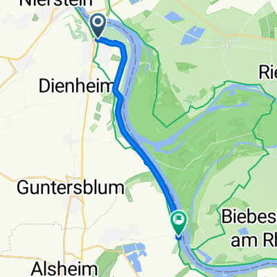
This is an Alternative section in Route 14A, which travels closer to the Rhine than the original described route (in the hard copy book), from Oppenheim to Gimbsheim.
Please note: I have not had the opportunity to cycle all of this section, so have had to rely on online sources to map parts of this route. Over the years I expect this section has been improved and is not as liable to flooding as it was in the past.- -:--
- Duration
- 10.4 km
- Distance
- 38 m
- Ascent
- 38 m
- Descent
- ---
- Avg. speed
- ---
- Max. altitude
Route quality
Waytypes & surfaces along the route
Waytypes
Track
9.1 km
(87 %)
Quiet road
0.8 km
(8 %)
Access road
0.5 km
(5 %)
Surfaces
Paved
1.4 km
(13 %)
Unpaved
7.1 km
(68 %)
Gravel
7.1 km
(68 %)
Asphalt
0.8 km
(8 %)
Route highlights
Points of interest along the route
Point of interest after 0 km
Continue straight on at this point for the alternative to the described route (Route 14A). This alternative route travels closer to the Rhine, all the way to Gimbsheim.
Point of interest after 0 km
The described route (Route 14A) continues in this direction.
Point of interest after 10.3 km
Rejoin the described route (Route 14A) at this point.
Continue with Bikemap
Use, edit, or download this cycling route
You would like to ride CYCLING THE RHINE: Route 14A.alt or customize it for your own trip? Here is what you can do with this Bikemap route:
Free features
- Save this route as favorite or in collections
- Copy & plan your own version of this route
- Sync your route with Garmin or Wahoo
Premium features
Free trial for 3 days, or one-time payment. More about Bikemap Premium.
- Navigate this route on iOS & Android
- Export a GPX / KML file of this route
- Create your custom printout (try it for free)
- Download this route for offline navigation
Discover more Premium features.
Get Bikemap PremiumFrom our community
Other popular routes starting in Oppenheim
 Runde ab Riedsee 45
- Distance
- 45.3 km
- Ascent
- 41 m
- Descent
- 41 m
- Location
- Oppenheim, Rhineland-Palatinate, Germany
 Ahnenroute 495km - Tag 6 - von Oppenheim nach Oftersheim
- Distance
- 74.4 km
- Ascent
- 139 m
- Descent
- 161 m
- Location
- Oppenheim, Rhineland-Palatinate, Germany
 Großer Preis von Oppenheim
- Distance
- 18.2 km
- Ascent
- 201 m
- Descent
- 211 m
- Location
- Oppenheim, Rhineland-Palatinate, Germany
 Touren
- Distance
- 2.7 km
- Ascent
- 6 m
- Descent
- 8 m
- Location
- Oppenheim, Rhineland-Palatinate, Germany
 CYCLING THE RHINE: Route 14A.alt
- Distance
- 10.4 km
- Ascent
- 38 m
- Descent
- 38 m
- Location
- Oppenheim, Rhineland-Palatinate, Germany
 The Hell (Der Echte Wadenzwicker)
- Distance
- 138.1 km
- Ascent
- 888 m
- Descent
- 886 m
- Location
- Oppenheim, Rhineland-Palatinate, Germany
 Nierstein Rheintour
- Distance
- 26.5 km
- Ascent
- 34 m
- Descent
- 36 m
- Location
- Oppenheim, Rhineland-Palatinate, Germany
 stockstadt
- Distance
- 54.7 km
- Ascent
- 27 m
- Descent
- 29 m
- Location
- Oppenheim, Rhineland-Palatinate, Germany
Open it in the app