

R04ArdaggerMelk
A cycling route starting in Amstetten, Lower Austria, Austria.
Overview
About this route
From the Bicycle Museum to the City of the Nibelungs / On this scenic long-distance bike path, you travel along the Danube from a small, quiet town called Ardagger to the city of Melk, the western gateway to the Wachau. In the picturesque Danube Valley, you pass through the towns of Hössgang, Ybbs an der Donau, Krummnussbaum and Pöchlarn, among others, before arriving in Melk, your destination. Ardagger - na levem bregu Grein - Hosgang - na levem bregu St. Nikola an der Donau - na levem bregu Weins - na levem Persenbeug-Gottsdorf - Ybbs an der Donau PRENOČIŠČE; pritok Ybbs) - Neusarling - Sarling - Sausenstein - Krummnusbaum - na levem bregu Marbach an der Donau-Am Rechen (pritok Erlauf)-Pochlarn-Melk (54 km, 130 m)
- -:--
- Duration
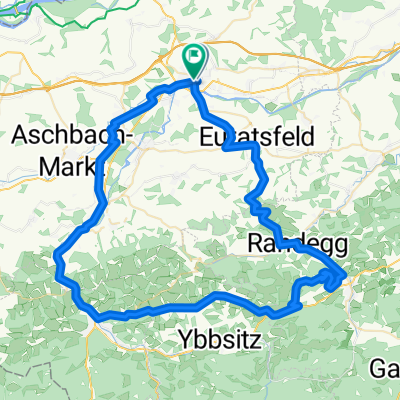
- 59.5 km
- Distance
- 793 m
- Ascent
- 811 m
- Descent
- ---
- Avg. speed
- 309 m
- Max. altitude

Route quality
Waytypes & surfaces along the route
Waytypes
Track
21.5 km
(36 %)
Quiet road
11.6 km
(20 %)
Surfaces
Paved
53.5 km
(90 %)
Unpaved
4.1 km
(7 %)
Asphalt
45.2 km
(76 %)
Concrete
6.9 km
(12 %)
Continue with Bikemap
Use, edit, or download this cycling route
You would like to ride R04ArdaggerMelk or customize it for your own trip? Here is what you can do with this Bikemap route:
Free features
- Save this route as favorite or in collections
- Copy & plan your own version of this route
- Sync your route with Garmin or Wahoo
Premium features
Free trial for 3 days, or one-time payment. More about Bikemap Premium.
- Navigate this route on iOS & Android
- Export a GPX / KML file of this route
- Create your custom printout (try it for free)
- Download this route for offline navigation
Discover more Premium features.
Get Bikemap PremiumFrom our community
Other popular routes starting in Amstetten
 Linz
Linz- Distance
- 115.4 km
- Ascent
- 105 m
- Descent
- 108 m
- Location
- Amstetten, Lower Austria, Austria
 Amstetten-Ybbs-Hengstberg-Neustadtl
- Distance
- 59.5 km
- Ascent
- 668 m
- Descent
- 667 m
- Location
- Amstetten, Lower Austria, Austria
 Amstetten nach Pfaffenschlag
- Distance
- 47.5 km
- Ascent
- 700 m
- Descent
- 262 m
- Location
- Amstetten, Lower Austria, Austria
 60er Ausfahrt Hannes
- Distance
- 112.3 km
- Ascent
- 1,091 m
- Descent
- 1,099 m
- Location
- Amstetten, Lower Austria, Austria
 AM-Hochkogel-Gresten-WY-AM
- Distance
- 77.5 km
- Ascent
- 799 m
- Descent
- 799 m
- Location
- Amstetten, Lower Austria, Austria
 Von Amstetten bis Lunz am See
- Distance
- 80 km
- Ascent
- 1,406 m
- Descent
- 1,090 m
- Location
- Amstetten, Lower Austria, Austria
 Hochkogel
- Distance
- 29.7 km
- Ascent
- 497 m
- Descent
- 496 m
- Location
- Amstetten, Lower Austria, Austria
 07.15 Hochpyra
- Distance
- 43.5 km
- Ascent
- 715 m
- Descent
- 711 m
- Location
- Amstetten, Lower Austria, Austria
Open it in the app