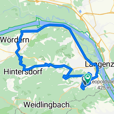
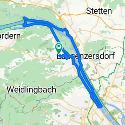
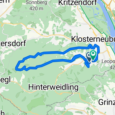
R07KlosterneuburgPetronell
A cycling route starting in Klosterneuburg, Lower Austria, Austria.
Overview
About this route
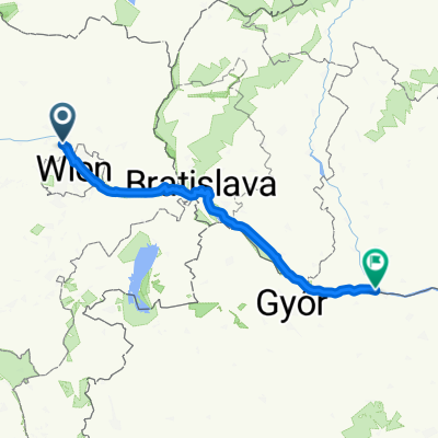
Tête-à-tête of culture and nature / On this seventh stage of the Danube Bike Path, long-distance cyclists pedal along the lovely Danube bank promenade in Vienna. Then the path runs along the north bank through the idyllic Danube Wetlands National Park. At Haslau, you cross the Danube and the route takes you to the south bank to Petronell. Klosterneuburg – prečkamo reko na levi breg preko otoka (North Bridge) - National park DONAU AUEN - Schonau an der Donau - prečkamo reko na desni breg Haslau an der Donau - Scharndorf - Petronell-Carnuntum (60 km, 325 m)
- -:--
- Duration
- 59.5 km
- Distance
- 284 m
- Ascent
- 265 m
- Descent
- ---
- Avg. speed
- 196 m
- Max. altitude
Route quality
Waytypes & surfaces along the route
Waytypes
Cycleway
18 km
(30 %)
Track
17.1 km
(29 %)
Surfaces
Paved
48.7 km
(82 %)
Unpaved
9.5 km
(16 %)
Asphalt
48.6 km
(82 %)
Gravel
8.3 km
(14 %)
Continue with Bikemap
Use, edit, or download this cycling route
You would like to ride R07KlosterneuburgPetronell or customize it for your own trip? Here is what you can do with this Bikemap route:
Free features
- Save this route as favorite or in collections
- Copy & plan your own version of this route
- Sync your route with Garmin or Wahoo
Premium features
Free trial for 3 days, or one-time payment. More about Bikemap Premium.
- Navigate this route on iOS & Android
- Export a GPX / KML file of this route
- Create your custom printout (try it for free)
- Download this route for offline navigation
Discover more Premium features.
Get Bikemap PremiumFrom our community
Other popular routes starting in Klosterneuburg
- 120_Donauinsel-Kreutal-Spannberg-Donauinsel
- Distance
- 119.8 km
- Ascent
- 393 m
- Descent
- 403 m
- Location
- Klosterneuburg, Lower Austria, Austria
- Klosterneuburg Loudonsche Türkensteine Mostalm
- Distance
- 51.2 km
- Ascent
- 913 m
- Descent
- 913 m
- Location
- Klosterneuburg, Lower Austria, Austria
- Home - Dreamland
- Distance
- 11.4 km
- Ascent
- 391 m
- Descent
- 316 m
- Location
- Klosterneuburg, Lower Austria, Austria
- AUT KLBG-Dopplerhütte-Greifenstein-Weinviertel-KLBG
- Distance
- 68.8 km
- Ascent
- 652 m
- Descent
- 661 m
- Location
- Klosterneuburg, Lower Austria, Austria
- KLBG-Tulln-Kreuzenstein
- Distance
- 83.3 km
- Ascent
- 690 m
- Descent
- 700 m
- Location
- Klosterneuburg, Lower Austria, Austria
- Babenbergerstrecke bis Windischhütte
- Distance
- 18.4 km
- Ascent
- 442 m
- Descent
- 442 m
- Location
- Klosterneuburg, Lower Austria, Austria
- forststrasse
- Distance
- 6 km
- Ascent
- 345 m
- Descent
- 380 m
- Location
- Klosterneuburg, Lower Austria, Austria
- Weidling - Höhenstraße - Tulbinger Kogel - Dopplerhütte - hintersdorf - Weidling
- Distance
- 63.6 km
- Ascent
- 1,491 m
- Descent
- 1,484 m
- Location
- Klosterneuburg, Lower Austria, Austria
Open it in the app