

May Route Plan
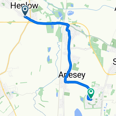
A cycling route starting in Henlow, England, United Kingdom.
Overview
About this route
Route created on plotaroute.com
- -:--
- Duration
- 99.7 km
- Distance
- 844 m
- Ascent
- 845 m
- Descent
- ---
- Avg. speed
- 195 m
- Max. altitude
Route quality
Waytypes & surfaces along the route
Waytypes
Road
45.6 km
(46 %)
Quiet road
27.3 km
(27 %)
Surfaces
Paved
21.2 km
(21 %)
Unpaved
3.7 km
(4 %)
Asphalt
20.2 km
(20 %)
Gravel
1.8 km
(2 %)
Continue with Bikemap
Use, edit, or download this cycling route
You would like to ride May Route Plan or customize it for your own trip? Here is what you can do with this Bikemap route:
Free features
- Save this route as favorite or in collections
- Copy & plan your own version of this route
- Split it into stages to create a multi-day tour
- Sync your route with Garmin or Wahoo
Premium features
Free trial for 3 days, or one-time payment. More about Bikemap Premium.
- Navigate this route on iOS & Android
- Export a GPX / KML file of this route
- Create your custom printout (try it for free)
- Download this route for offline navigation
Discover more Premium features.
Get Bikemap PremiumFrom our community
Other popular routes starting in Henlow
 Welchs Close, Henlow to Greenfields, Hitchin
- Distance
- 11 km
- Ascent
- 77 m
- Descent
- 68 m
- Location
- Henlow, England, United Kingdom
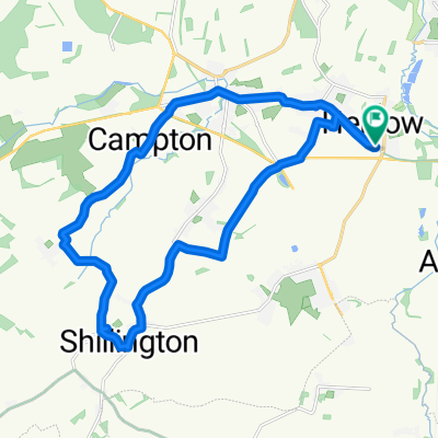
 Biggleswade circle
- Distance
- 57.8 km
- Ascent
- 320 m
- Descent
- 320 m
- Location
- Henlow, England, United Kingdom
 2–98 Westfield Road, Henlow to 32 Biggleswade Road, Biggleswade
- Distance
- 9.4 km
- Ascent
- 14 m
- Descent
- 21 m
- Location
- Henlow, England, United Kingdom
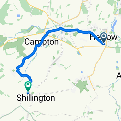
 Henlow-Sundon
- Distance
- 55.1 km
- Ascent
- 396 m
- Descent
- 397 m
- Location
- Henlow, England, United Kingdom
 Welchs Close, Henlow to Dickens Boulevard, Hitchin
- Distance
- 6.2 km
- Ascent
- 56 m
- Descent
- 24 m
- Location
- Henlow, England, United Kingdom
 2–98 Westfield Road, Henlow to 32 Biggleswade Road, Biggleswade
- Distance
- 9.5 km
- Ascent
- 15 m
- Descent
- 25 m
- Location
- Henlow, England, United Kingdom
 Welchs Close, Henlow to Welchs Close, Henlow
- Distance
- 20.7 km
- Ascent
- 127 m
- Descent
- 127 m
- Location
- Henlow, England, United Kingdom
 Welchs Close, Henlow to Greenfields, Hitchin
- Distance
- 11 km
- Ascent
- 78 m
- Descent
- 65 m
- Location
- Henlow, England, United Kingdom
Open it in the app