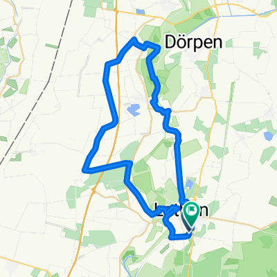
Lathen_4_-_Kloster_Ter_Aepel
A cycling route starting in Lathen, Lower Saxony, Germany.
Overview
About this route
These GPS data are the property of the geo-coaching project and are intended solely for private use. Commercial use is not permitted without permission.
- -:--
- Duration
- 58 km
- Distance
- 62 m
- Ascent
- 61 m
- Descent
- ---
- Avg. speed
- 23 m
- Max. altitude
Route quality
Waytypes & surfaces along the route
Waytypes
Quiet road
39.5 km
(68 %)
Road
5.8 km
(10 %)
Surfaces
Paved
55.1 km
(95 %)
Unpaved
0.6 km
(1 %)
Asphalt
52.8 km
(91 %)
Concrete
2.3 km
(4 %)
Continue with Bikemap
Use, edit, or download this cycling route
You would like to ride Lathen_4_-_Kloster_Ter_Aepel or customize it for your own trip? Here is what you can do with this Bikemap route:
Free features
- Save this route as favorite or in collections
- Copy & plan your own version of this route
- Sync your route with Garmin or Wahoo
Premium features
Free trial for 3 days, or one-time payment. More about Bikemap Premium.
- Navigate this route on iOS & Android
- Export a GPX / KML file of this route
- Create your custom printout (try it for free)
- Download this route for offline navigation
Discover more Premium features.
Get Bikemap PremiumFrom our community
Other popular routes starting in Lathen
Marschstraße, Lathen nach Marschstraße, Lathen- Distance
- 29.9 km
- Ascent
- 676 m
- Descent
- 676 m
- Location
- Lathen, Lower Saxony, Germany
Ross_und_Rad- Distance
- 39.3 km
- Ascent
- 88 m
- Descent
- 87 m
- Location
- Lathen, Lower Saxony, Germany
29 august Fra Lathen til Uelsen- Distance
- 68.1 km
- Ascent
- 45 m
- Descent
- 16 m
- Location
- Lathen, Lower Saxony, Germany
lathen- Distance
- 35.3 km
- Ascent
- 87 m
- Descent
- 88 m
- Location
- Lathen, Lower Saxony, Germany
Rund um Lathen- Distance
- 37.8 km
- Ascent
- 48 m
- Descent
- 48 m
- Location
- Lathen, Lower Saxony, Germany
Rund um Lathen Route 2- Distance
- 37.4 km
- Ascent
- 64 m
- Descent
- 63 m
- Location
- Lathen, Lower Saxony, Germany
N-NL dag 9 Denekamp 90km- Distance
- 89.5 km
- Ascent
- 76 m
- Descent
- 62 m
- Location
- Lathen, Lower Saxony, Germany
Ems-Radweg E2 (Lathen -> Rheine)- Distance
- 108.1 km
- Ascent
- 106 m
- Descent
- 76 m
- Location
- Lathen, Lower Saxony, Germany
Open it in the app


