
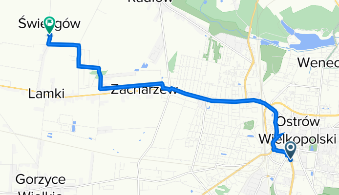
Wrocławska 54, Ostrów Wielkopolski do Świeligów 15, Świeligów
A cycling route starting in Ostrów Wielkopolski, Greater Poland Voivodeship, Poland.
Overview
About this route
- 37 min
- Duration
- 8.4 km
- Distance
- 180 m
- Ascent
- 175 m
- Descent
- 13.7 km/h
- Avg. speed
- 152 m
- Avg. speed

Route quality
Waytypes & surfaces along the route
Waytypes
Pedestrian area
3.1 km
(37 %)
Quiet road
1.8 km
(21 %)
Surfaces
Paved
3.4 km
(40 %)
Unpaved
0.5 km
(6 %)
Asphalt
2.9 km
(34 %)
Paving stones
0.4 km
(5 %)
Continue with Bikemap
Use, edit, or download this cycling route
You would like to ride Wrocławska 54, Ostrów Wielkopolski do Świeligów 15, Świeligów or customize it for your own trip? Here is what you can do with this Bikemap route:
Free features
- Save this route as favorite or in collections
- Copy & plan your own version of this route
- Sync your route with Garmin or Wahoo
Premium features
Free trial for 3 days, or one-time payment. More about Bikemap Premium.
- Navigate this route on iOS & Android
- Export a GPX / KML file of this route
- Create your custom printout (try it for free)
- Download this route for offline navigation
Discover more Premium features.
Get Bikemap PremiumFrom our community
Other popular routes starting in Ostrów Wielkopolski
 Wieczorna przejażdżka 🚲
- Distance
- 18.3 km
- Ascent
- 792 m
- Descent
- 806 m
- Location
- Ostrów Wielkopolski, Greater Poland Voivodeship, Poland
 🚲 Ostrów - Czekanów - Michałków - Ostrów
- Distance
- 18.7 km
- Ascent
- 793 m
- Descent
- 786 m
- Location
- Ostrów Wielkopolski, Greater Poland Voivodeship, Poland
 Ostrów - Wiatraki
- Distance
- 6.6 km
- Ascent
- 27 m
- Descent
- 28 m
- Location
- Ostrów Wielkopolski, Greater Poland Voivodeship, Poland
 Ostrów Wlkp. Strzelecka - Janków Przygodzki
- Distance
- 24.2 km
- Ascent
- 103 m
- Descent
- 103 m
- Location
- Ostrów Wielkopolski, Greater Poland Voivodeship, Poland
 zielona, wolna od smogu, droga po lesie. W sam raz na jesień i zimę. Konieczne szerokie opony.
- Distance
- 41.5 km
- Ascent
- 483 m
- Descent
- 472 m
- Location
- Ostrów Wielkopolski, Greater Poland Voivodeship, Poland
 Koniec Świata (gps)
- Distance
- 102 km
- Ascent
- 240 m
- Descent
- 240 m
- Location
- Ostrów Wielkopolski, Greater Poland Voivodeship, Poland
 Ostrow Wielkopolski - Wroclaw
- Distance
- 113.5 km
- Ascent
- 307 m
- Descent
- 321 m
- Location
- Ostrów Wielkopolski, Greater Poland Voivodeship, Poland
 Dziki zachód
- Distance
- 811.9 km
- Ascent
- 698 m
- Descent
- 830 m
- Location
- Ostrów Wielkopolski, Greater Poland Voivodeship, Poland
Open it in the app