Autenried-Babenhausen-Kellmünz-Autenried
A cycling route starting in Rieden an der Kötz, Bavaria, Germany.
Overview
About this route
The riding time has been strongly 'exaggerated' since uploading, no idea why. I had 3:10 on the clock when I got home. The distance and elevation are correct.
- 5 h 50 min
- Duration
- 92.3 km
- Distance
- 644 m
- Ascent
- 641 m
- Descent
- 15.8 km/h
- Avg. speed
- 610 m
- Max. altitude
Route quality
Waytypes & surfaces along the route
Waytypes
Quiet road
32.3 km
(35 %)
Road
24.9 km
(27 %)
Surfaces
Paved
79.4 km
(86 %)
Asphalt
72.9 km
(79 %)
Paved (undefined)
6.5 km
(7 %)
Undefined
12.9 km
(14 %)
Continue with Bikemap
Use, edit, or download this cycling route
You would like to ride Autenried-Babenhausen-Kellmünz-Autenried or customize it for your own trip? Here is what you can do with this Bikemap route:
Free features
- Save this route as favorite or in collections
- Copy & plan your own version of this route
- Split it into stages to create a multi-day tour
- Sync your route with Garmin or Wahoo
Premium features
Free trial for 3 days, or one-time payment. More about Bikemap Premium.
- Navigate this route on iOS & Android
- Export a GPX / KML file of this route
- Create your custom printout (try it for free)
- Download this route for offline navigation
Discover more Premium features.
Get Bikemap PremiumFrom our community
Other popular routes starting in Rieden an der Kötz
- Kleine Tour durch's Bibertal
- Distance
- 25.4 km
- Ascent
- 127 m
- Descent
- 109 m
- Location
- Rieden an der Kötz, Bavaria, Germany
- Autenried-Babenhausen-Kellmünz-Autenried
- Distance
- 92.3 km
- Ascent
- 644 m
- Descent
- 641 m
- Location
- Rieden an der Kötz, Bavaria, Germany
- Autenried-Wasserberg-Ebershausen
- Distance
- 100.7 km
- Ascent
- 891 m
- Descent
- 892 m
- Location
- Rieden an der Kötz, Bavaria, Germany
- Gravel-Autenried-Silbersee-Offingen-Günzburg
- Distance
- 50.2 km
- Ascent
- 460 m
- Descent
- 459 m
- Location
- Rieden an der Kötz, Bavaria, Germany
- Graveltour-Autenried-Roggenburg-Marienfried-Autenried
- Distance
- 45.7 km
- Ascent
- 457 m
- Descent
- 451 m
- Location
- Rieden an der Kötz, Bavaria, Germany
- Günz-Bibertal-Tour
- Distance
- 40.6 km
- Ascent
- 195 m
- Descent
- 195 m
- Location
- Rieden an der Kötz, Bavaria, Germany
- GRAVEL-Autenried-Kalvarienberg-Silbersee-Günzburg-Autenried
- Distance
- 75.2 km
- Ascent
- 640 m
- Descent
- 634 m
- Location
- Rieden an der Kötz, Bavaria, Germany
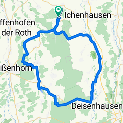
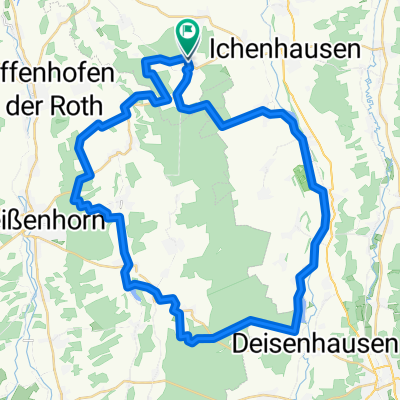
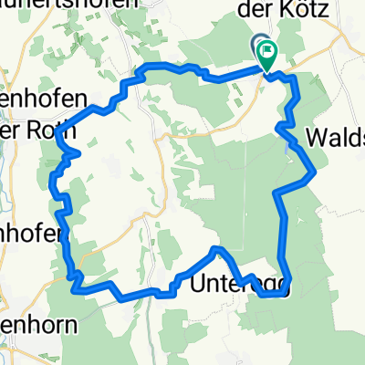
- Autenried-Wasserberg-Burg-Autenried Gravel
- Distance
- 96.5 km
- Ascent
- 473 m
- Descent
- 471 m
- Location
- Rieden an der Kötz, Bavaria, Germany
Open it in the app