

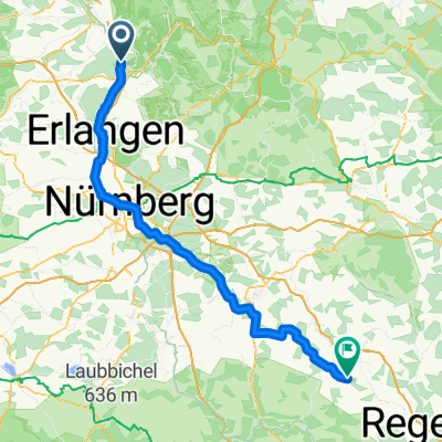
FO-Adelsdorf-Willersdorf
A cycling route starting in Forchheim, Bavaria, Germany.
Overview
About this route
- -:--
- Duration
- 38.1 km
- Distance
- 245 m
- Ascent
- 241 m
- Descent
- ---
- Avg. speed
- 342 m
- Max. altitude

Route quality
Waytypes & surfaces along the route
Waytypes
Track
13.7 km
(36 %)
Road
9.2 km
(24 %)
Surfaces
Paved
27.8 km
(73 %)
Unpaved
9.2 km
(24 %)
Asphalt
26.7 km
(70 %)
Gravel
6.5 km
(17 %)
Route highlights
Points of interest along the route
Point of interest after 23.8 km
Pause!! :-)
Continue with Bikemap
Use, edit, or download this cycling route
You would like to ride FO-Adelsdorf-Willersdorf or customize it for your own trip? Here is what you can do with this Bikemap route:
Free features
- Save this route as favorite or in collections
- Copy & plan your own version of this route
- Sync your route with Garmin or Wahoo
Premium features
Free trial for 3 days, or one-time payment. More about Bikemap Premium.
- Navigate this route on iOS & Android
- Export a GPX / KML file of this route
- Create your custom printout (try it for free)
- Download this route for offline navigation
Discover more Premium features.
Get Bikemap PremiumFrom our community
Other popular routes starting in Forchheim
 Sattlertorstraße 19, Forchheim nach Sattlertorstraße 36, Forchheim
- Distance
- 18.8 km
- Ascent
- 714 m
- Descent
- 702 m
- Location
- Forchheim, Bavaria, Germany
 FP-Jahresabschlußfahrt am 18.10.2014
- Distance
- 78.8 km
- Ascent
- 383 m
- Descent
- 385 m
- Location
- Forchheim, Bavaria, Germany
 Dechsendorf
- Distance
- 35.5 km
- Ascent
- 236 m
- Descent
- 236 m
- Location
- Forchheim, Bavaria, Germany
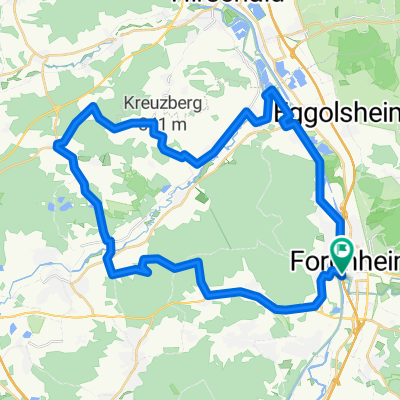
 Forchheim-Aischgrund-Kreuzberg
- Distance
- 37.7 km
- Ascent
- 249 m
- Descent
- 255 m
- Location
- Forchheim, Bavaria, Germany
 Forchheim - kurze Feierabendrunde
- Distance
- 20.8 km
- Ascent
- 200 m
- Descent
- 133 m
- Location
- Forchheim, Bavaria, Germany
 Forchheimer Radrundweg FO 1
- Distance
- 32.4 km
- Ascent
- 246 m
- Descent
- 246 m
- Location
- Forchheim, Bavaria, Germany
 Forchheim - Lupburg
- Distance
- 117.5 km
- Ascent
- 985 m
- Descent
- 688 m
- Location
- Forchheim, Bavaria, Germany
 Aischtal_Bierkellerrunde
- Distance
- 43.2 km
- Ascent
- 457 m
- Descent
- 456 m
- Location
- Forchheim, Bavaria, Germany
Open it in the app