Soria - Laguna Negra
- 225.7 km
- 3,941 m
- 3,310 m
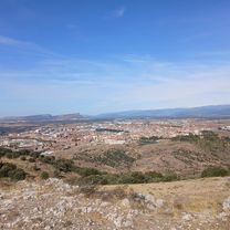
- Soria, Castille and León, Spain
A cycling route starting in Soria, Castille and León, Spain.
Overview
Agua Soriano 1
created this 3 years ago
Route quality
Track
41.2 km
(69 %)
Road
11.4 km
(19 %)
Paved
13.1 km
(22 %)
Unpaved
44.8 km
(75 %)
Gravel
44.8 km
(75 %)
Asphalt
13.1 km
(22 %)
Undefined
1.8 km
(3 %)
Continue with Bikemap
You would like to ride Agua Soriano / Camino Antonino I or customize it for your own trip? Here is what you can do with this Bikemap route:
Free trial for 3 days, or one-time payment. More about Bikemap Premium.
Discover more Premium features.
Get Bikemap PremiumFrom our community
Open it in the app