

Nation's Garden - Acelle Plateau
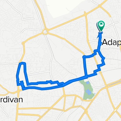
A cycling route starting in Adapazarı, Sakarya Province, Republic of Türkiye.
Overview
About this route
- -:--
- Duration
- 59.8 km
- Distance
- 2,060 m
- Ascent
- 900 m
- Descent
- ---
- Avg. speed
- 1,262 m
- Max. altitude

Route quality
Waytypes & surfaces along the route
Waytypes
Road
38.3 km
(64 %)
Quiet road
9 km
(15 %)
Surfaces
Paved
15 km
(25 %)
Unpaved
0.6 km
(1 %)
Asphalt
15 km
(25 %)
Unpaved (undefined)
0.6 km
(1 %)
Undefined
44.3 km
(74 %)
Continue with Bikemap
Use, edit, or download this cycling route
You would like to ride Nation's Garden - Acelle Plateau or customize it for your own trip? Here is what you can do with this Bikemap route:
Free features
- Save this route as favorite or in collections
- Copy & plan your own version of this route
- Sync your route with Garmin or Wahoo
Premium features
Free trial for 3 days, or one-time payment. More about Bikemap Premium.
- Navigate this route on iOS & Android
- Export a GPX / KML file of this route
- Create your custom printout (try it for free)
- Download this route for offline navigation
Discover more Premium features.
Get Bikemap PremiumFrom our community
Other popular routes starting in Adapazarı
 k123
k123- Distance
- 112.6 km
- Ascent
- 184 m
- Descent
- 211 m
- Location
- Adapazarı, Sakarya Province, Republic of Türkiye
 saski - subu
- Distance
- 13.6 km
- Ascent
- 16 m
- Descent
- 13 m
- Location
- Adapazarı, Sakarya Province, Republic of Türkiye
 first day
- Distance
- 6.9 km
- Ascent
- 4 m
- Descent
- 4 m
- Location
- Adapazarı, Sakarya Province, Republic of Türkiye
 Şehit Yüzbaşı Yalçın Aydın Caddesi 16 to Şehit Cevdet Özdemir Sokak 6
- Distance
- 10.3 km
- Ascent
- 293 m
- Descent
- 259 m
- Location
- Adapazarı, Sakarya Province, Republic of Türkiye
 sakarya izmit
- Distance
- 56.4 km
- Ascent
- 364 m
- Descent
- 190 m
- Location
- Adapazarı, Sakarya Province, Republic of Türkiye
 Adapazarı - Rüstemler
- Distance
- 22.8 km
- Ascent
- 33 m
- Descent
- 44 m
- Location
- Adapazarı, Sakarya Province, Republic of Türkiye
 Bostanci Sk. 24, Adapazari to Doner Sk. 28, Serdivan
- Distance
- 4.5 km
- Ascent
- 25 m
- Descent
- 4 m
- Location
- Adapazarı, Sakarya Province, Republic of Türkiye
 Şehit Yüzbaşı Yalçın Aydın Caddesi 14 to Şehit Remzi Özüpek Sokak 5
- Distance
- 9.4 km
- Ascent
- 272 m
- Descent
- 273 m
- Location
- Adapazarı, Sakarya Province, Republic of Türkiye
Open it in the app