

29. maj
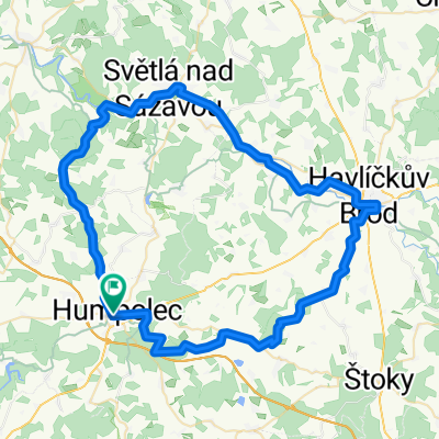
A cycling route starting in Humpolec, Kraj Vysočina, Czechia.
Overview
About this route
- -:--
- Duration
- 73 km
- Distance
- 1,310 m
- Ascent
- 1,473 m
- Descent
- ---
- Avg. speed
- 528 m
- Avg. speed

Route quality
Waytypes & surfaces along the route
Waytypes
Road
41.1 km
(56 %)
Quiet road
12.7 km
(17 %)
Surfaces
Paved
8.9 km
(12 %)
Unpaved
4.1 km
(6 %)
Asphalt
7.8 km
(11 %)
Ground
1.8 km
(2 %)
Route highlights
Points of interest along the route
Point of interest after 5.1 km
Sedlická přehrada
Point of interest after 11.5 km
Stará prelatura
Point of interest after 11.5 km
Žižkův dub letní - Želiv
Point of interest after 11.6 km
Ostrov zapomnění
Point of interest after 11.7 km
Trčkův hrad
Point of interest after 11.7 km
Želiv monastery
Point of interest after 12.1 km
Boží muka
Point of interest after 27.1 km
Rybníček u Studeného
Point of interest after 32.5 km
Kostel Narození Panny Marie
Point of interest after 35.8 km
Kaplička sv. Petra a Pavla
Point of interest after 38.3 km
Keblov - kostel Nanebevzetí Panny Marie
Point of interest after 42.3 km
Památník obětí 1. sv. války
Point of interest after 52.5 km
Kaple sv. P. Marie Hrádecké
Point of interest after 53.6 km
Jez Kácov
Point of interest after 53.7 km
Památník obětem válek
Point of interest after 61.7 km
Kostel sv. Havla
Continue with Bikemap
Use, edit, or download this cycling route
You would like to ride 29. maj or customize it for your own trip? Here is what you can do with this Bikemap route:
Free features
- Save this route as favorite or in collections
- Copy & plan your own version of this route
- Sync your route with Garmin or Wahoo
Premium features
Free trial for 3 days, or one-time payment. More about Bikemap Premium.
- Navigate this route on iOS & Android
- Export a GPX / KML file of this route
- Create your custom printout (try it for free)
- Download this route for offline navigation
Discover more Premium features.
Get Bikemap PremiumFrom our community
Other popular routes starting in Humpolec
 Humpolecká 50
- Distance
- 25.9 km
- Ascent
- 474 m
- Descent
- 474 m
- Location
- Humpolec, Kraj Vysočina, Czechia
 Humpolec-pod Křemešníkem-Pelhřimov-Sedlice-U Pihávka-Humpolec (Corrida)
- Distance
- 51.6 km
- Ascent
- 697 m
- Descent
- 699 m
- Location
- Humpolec, Kraj Vysočina, Czechia
 Humpolec - Proseč - Stará Huť - Kaliště - Lohenice - Speřice - Kopaniny - Jiřice - Hněvkovice - Humpolec
- Distance
- 26.5 km
- Ascent
- 313 m
- Descent
- 305 m
- Location
- Humpolec, Kraj Vysočina, Czechia
 Jiřické kopečky 2 aneb Pain in the ass
- Distance
- 33.7 km
- Ascent
- 475 m
- Descent
- 475 m
- Location
- Humpolec, Kraj Vysočina, Czechia
 29. maj
- Distance
- 73 km
- Ascent
- 1,310 m
- Descent
- 1,473 m
- Location
- Humpolec, Kraj Vysočina, Czechia
 Humpolec - Proseč - Kejžlice - Rozkoš - Humpolec
- Distance
- 25.8 km
- Ascent
- 364 m
- Descent
- 365 m
- Location
- Humpolec, Kraj Vysočina, Czechia
 Humpolec-Rohule-Světlá nad Sázavou-Havlíčkův Brod-Lípa-Herálec-Plačkov-Humpolec
- Distance
- 69.1 km
- Ascent
- 607 m
- Descent
- 605 m
- Location
- Humpolec, Kraj Vysočina, Czechia
 Z HUMPOLCE K ŘECE SÁZAVA, LIPNICI NAD SÁZAVOU, HRADU ORLÍK A ZPĚT DO HUMPOLCE
- Distance
- 47.7 km
- Ascent
- 739 m
- Descent
- 739 m
- Location
- Humpolec, Kraj Vysočina, Czechia
Open it in the app