

Medley aus NU1, NU2, NU3 und Iller-Radwanderweg
A cycling route starting in Ulm, Baden-Württemberg, Germany.
Overview
About this route
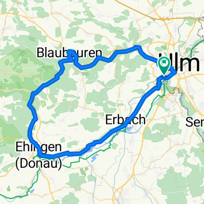
Der Hinweg vereint Teile aus den Randwanderwegen Neu-Ulm 1 bis 3. In Dietenheim könnte man gerade noch 'ne Pizza schnappen, bevor es auf dem Iller-Radwanderweg nach Hause geht.
viel Spass!
80km, 300Hm, Asphalt und Schotter
- -:--
- Duration
- 79 km
- Distance
- 198 m
- Ascent
- 200 m
- Descent
- ---
- Avg. speed
- ---
- Avg. speed
Route quality
Waytypes & surfaces along the route
Waytypes
Track
25.2 km
(32 %)
Quiet road
25 km
(32 %)
Surfaces
Paved
47.9 km
(61 %)
Unpaved
22.4 km
(28 %)
Asphalt
44.6 km
(56 %)
Gravel
11.8 km
(15 %)
Continue with Bikemap
Use, edit, or download this cycling route
You would like to ride Medley aus NU1, NU2, NU3 und Iller-Radwanderweg or customize it for your own trip? Here is what you can do with this Bikemap route:
Free features
- Save this route as favorite or in collections
- Copy & plan your own version of this route
- Sync your route with Garmin or Wahoo
Premium features
Free trial for 3 days, or one-time payment. More about Bikemap Premium.
- Navigate this route on iOS & Android
- Export a GPX / KML file of this route
- Create your custom printout (try it for free)
- Download this route for offline navigation
Discover more Premium features.
Get Bikemap PremiumFrom our community
Other popular routes starting in Ulm
 Ulm-Donau-Bodensee-Iller
- Distance
- 405.6 km
- Ascent
- 754 m
- Descent
- 753 m
- Location
- Ulm, Baden-Württemberg, Germany
 Donauradweg Ulm nach Passa_TheBest
- Distance
- 386.8 km
- Ascent
- 175 m
- Descent
- 351 m
- Location
- Ulm, Baden-Württemberg, Germany
 Blaustein-Örlingen-Donau
- Distance
- 28.9 km
- Ascent
- 222 m
- Descent
- 219 m
- Location
- Ulm, Baden-Württemberg, Germany
 25 km Trainingsroute Ulm
- Distance
- 25.1 km
- Ascent
- 90 m
- Descent
- 87 m
- Location
- Ulm, Baden-Württemberg, Germany
 Trainingsfahrt im Ulmer Norden
- Distance
- 35.6 km
- Ascent
- 337 m
- Descent
- 340 m
- Location
- Ulm, Baden-Württemberg, Germany
 1.Etappe Ulm-Gardasee-Ulm
- Distance
- 137 km
- Ascent
- 417 m
- Descent
- 509 m
- Location
- Ulm, Baden-Württemberg, Germany
 Hills @Blautal
- Distance
- 48.9 km
- Ascent
- 540 m
- Descent
- 540 m
- Location
- Ulm, Baden-Württemberg, Germany
 Ulm - Blaubeuren - Ehingen - Erbach - Ulm
- Distance
- 68.1 km
- Ascent
- 266 m
- Descent
- 266 m
- Location
- Ulm, Baden-Württemberg, Germany
Open it in the app