

Trainingsfahrt im Ulmer Norden
A cycling route starting in Ulm, Baden-Württemberg, Germany.
Overview
About this route
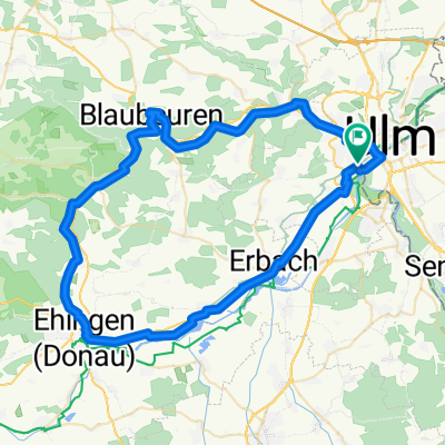
<span style="font-family: Arial, Helvetica, sans-serif; font-size: 11px;">Man startet entlang der Donau in Richtung Thalfingen. Dieser Abschnitt ist sehr flach.</span>
<span style="font-family: Arial, Helvetica, sans-serif; font-size: 11px;"> Danach wird es hügelig. Auf der Strecke sind drei schöne Anstiege, von denen gleich der erste (ab Km 9) am anstrengendsten ist. Hat man diesen erklommen (und noch ein paar Meter Schotterweg durch den Wald hinter sich gebracht), bietet sich einem aber ein wunderschöner Ausblick. Die anderen beiden Steigungen (Km 16 & 21) sind auch sehr ruhige, kleine Landstraßen. Das macht richtig Spaß dort zu fahren.</span>
<span style="font-family: Arial, Helvetica, sans-serif; font-size: 11px;">Ab Jungingen ist die Gegend dann mehr industriell und teilweise zu sehr befahren. Aber dann ist man ja auch schon fast wieder zurück in Ulm.</span>
- -:--
- Duration
- 35.6 km
- Distance
- 337 m
- Ascent
- 340 m
- Descent
- ---
- Avg. speed
- ---
- Avg. speed

Route quality
Waytypes & surfaces along the route
Waytypes
Road
11.9 km
(33 %)
Path
7.8 km
(22 %)
Surfaces
Paved
33.1 km
(93 %)
Unpaved
1 km
(3 %)
Asphalt
30.6 km
(86 %)
Paved (undefined)
2.1 km
(6 %)
Continue with Bikemap
Use, edit, or download this cycling route
You would like to ride Trainingsfahrt im Ulmer Norden or customize it for your own trip? Here is what you can do with this Bikemap route:
Free features
- Save this route as favorite or in collections
- Copy & plan your own version of this route
- Sync your route with Garmin or Wahoo
Premium features
Free trial for 3 days, or one-time payment. More about Bikemap Premium.
- Navigate this route on iOS & Android
- Export a GPX / KML file of this route
- Create your custom printout (try it for free)
- Download this route for offline navigation
Discover more Premium features.
Get Bikemap PremiumFrom our community
Other popular routes starting in Ulm
 Trainingsfahrt im Ulmer Norden
- Distance
- 35.6 km
- Ascent
- 337 m
- Descent
- 340 m
- Location
- Ulm, Baden-Württemberg, Germany
 Donauradweg Ulm nach Passa_TheBest
- Distance
- 386.8 km
- Ascent
- 175 m
- Descent
- 351 m
- Location
- Ulm, Baden-Württemberg, Germany
 Blaustein-Örlingen-Donau
- Distance
- 28.9 km
- Ascent
- 222 m
- Descent
- 219 m
- Location
- Ulm, Baden-Württemberg, Germany
 Ulm_Kempten_Lindau
- Distance
- 190.1 km
- Ascent
- 1,603 m
- Descent
- 1,682 m
- Location
- Ulm, Baden-Württemberg, Germany
 25 km Trainingsroute Ulm
- Distance
- 25.1 km
- Ascent
- 90 m
- Descent
- 87 m
- Location
- Ulm, Baden-Württemberg, Germany
 Hills @Blautal
- Distance
- 48.9 km
- Ascent
- 540 m
- Descent
- 540 m
- Location
- Ulm, Baden-Württemberg, Germany
 Ulm-Donau-Bodensee-Iller
- Distance
- 405.6 km
- Ascent
- 754 m
- Descent
- 753 m
- Location
- Ulm, Baden-Württemberg, Germany
 Ulm - Blaubeuren - Ehingen - Erbach - Ulm
- Distance
- 68.1 km
- Ascent
- 266 m
- Descent
- 266 m
- Location
- Ulm, Baden-Württemberg, Germany
Open it in the app