

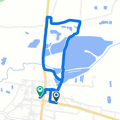
Z Kraśnika - Zakopanego.
A cycling route starting in Zaklików, Subcarpathian Voivodeship, Poland.
Overview
About this route
- 7 min
- Duration
- 1.3 km
- Distance
- 7 m
- Ascent
- 7 m
- Descent
- 11.1 km/h
- Avg. speed
- 187 m
- Max. altitude

Route quality
Waytypes & surfaces along the route
Waytypes
Quiet road
1 km
(82 %)
Track
0.1 km
(6 %)
Undefined
0.2 km
(12 %)
Surfaces
Paved
0.2 km
(12 %)
Unpaved
1 km
(77 %)
Unpaved (undefined)
1 km
(77 %)
Asphalt
0.2 km
(12 %)
Undefined
0.1 km
(11 %)
Continue with Bikemap
Use, edit, or download this cycling route
You would like to ride Z Kraśnika - Zakopanego. or customize it for your own trip? Here is what you can do with this Bikemap route:
Free features
- Save this route as favorite or in collections
- Copy & plan your own version of this route
- Sync your route with Garmin or Wahoo
Premium features
Free trial for 3 days, or one-time payment. More about Bikemap Premium.
- Navigate this route on iOS & Android
- Export a GPX / KML file of this route
- Create your custom printout (try it for free)
- Download this route for offline navigation
Discover more Premium features.
Get Bikemap PremiumFrom our community
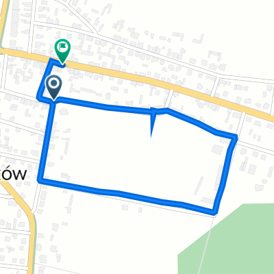
Other popular routes starting in Zaklików
 Z Klekocią na rowerze
- Distance
- 2.5 km
- Ascent
- 25 m
- Descent
- 22 m
- Location
- Zaklików, Subcarpathian Voivodeship, Poland
 Wierzchowiska
- Distance
- 93.6 km
- Ascent
- 201 m
- Descent
- 203 m
- Location
- Zaklików, Subcarpathian Voivodeship, Poland
 Brejdak2023_600_2_2_DOJ
- Distance
- 335.5 km
- Ascent
- 2,243 m
- Descent
- 2,211 m
- Location
- Zaklików, Subcarpathian Voivodeship, Poland
 Z Kraśnika - Zakopanego.
- Distance
- 1.3 km
- Ascent
- 7 m
- Descent
- 7 m
- Location
- Zaklików, Subcarpathian Voivodeship, Poland
 Śladem Kolejki Waskotorowej
- Distance
- 20.1 km
- Ascent
- 67 m
- Descent
- 41 m
- Location
- Zaklików, Subcarpathian Voivodeship, Poland
 roztocze
- Distance
- 384 km
- Ascent
- 573 m
- Descent
- 549 m
- Location
- Zaklików, Subcarpathian Voivodeship, Poland
 Śladem Kolejki Waskotorowej
- Distance
- 20.1 km
- Ascent
- 93 m
- Descent
- 60 m
- Location
- Zaklików, Subcarpathian Voivodeship, Poland
 Skrzynki Zaklików - Rudnik
- Distance
- 104.8 km
- Ascent
- 196 m
- Descent
- 212 m
- Location
- Zaklików, Subcarpathian Voivodeship, Poland
Open it in the app