
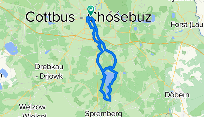
Cottbus - Talsperre Spremberg (Umrundung) - Cottbus
A cycling route starting in Cottbus, Brandenburg, Germany.
Overview
About this route
- 2 h 38 min
- Duration
- 50.6 km
- Distance
- 134 m
- Ascent
- 133 m
- Descent
- 19.3 km/h
- Avg. speed
- 125 m
- Max. altitude

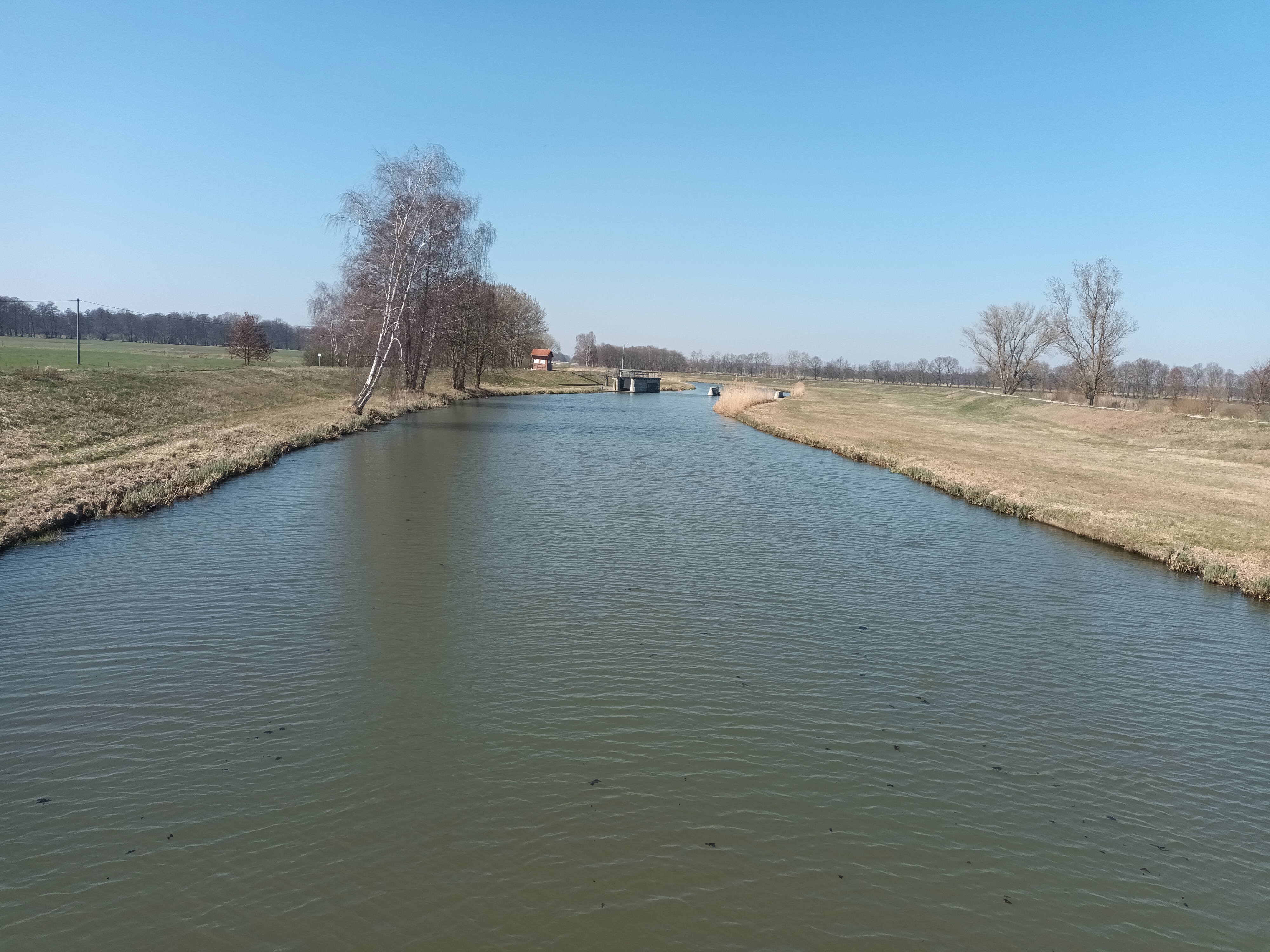
Route photos
 - Cottbus\"")
 - Cottbus\"")
 - Cottbus\"")
Route quality
Waytypes & surfaces along the route
Waytypes
Path
26.8 km
(53 %)
Quiet road
9.5 km
(19 %)
Surfaces
Paved
42.9 km
(85 %)
Unpaved
3.6 km
(7 %)
Asphalt
39.4 km
(78 %)
Loose gravel
3.1 km
(6 %)
Continue with Bikemap
Use, edit, or download this cycling route
You would like to ride Cottbus - Talsperre Spremberg (Umrundung) - Cottbus or customize it for your own trip? Here is what you can do with this Bikemap route:
Free features
- Save this route as favorite or in collections
- Copy & plan your own version of this route
- Sync your route with Garmin or Wahoo
Premium features
Free trial for 3 days, or one-time payment. More about Bikemap Premium.
- Navigate this route on iOS & Android
- Export a GPX / KML file of this route
- Create your custom printout (try it for free)
- Download this route for offline navigation
Discover more Premium features.
Get Bikemap PremiumFrom our community
Other popular routes starting in Cottbus
 Ostsee Rundweg
- Distance
- 34.1 km
- Ascent
- 69 m
- Descent
- 70 m
- Location
- Cottbus, Brandenburg, Germany
 Straubitz Mühle
- Distance
- 69.4 km
- Ascent
- 55 m
- Descent
- 14 m
- Location
- Cottbus, Brandenburg, Germany
 BRT2013-MO: Durchs Strittmacherland - RTF der Spremberger Stahlwaden e.V. beim BRT2013 in Cottbus - 115 km Strecke
- Distance
- 130.8 km
- Ascent
- 343 m
- Descent
- 344 m
- Location
- Cottbus, Brandenburg, Germany
 Cottbus - Talsperre Spremberg (Umrundung) - Cottbus
- Distance
- 50.6 km
- Ascent
- 134 m
- Descent
- 133 m
- Location
- Cottbus, Brandenburg, Germany
 Unsere Route ♥
- Distance
- 21.3 km
- Ascent
- 33 m
- Descent
- 33 m
- Location
- Cottbus, Brandenburg, Germany
 BRT2013-SA: Sparkassen - Tour - RTF der Radsportclub Cottbus e.V. - Veloteam beim BRT2013 in Cottbus - 115 km Strecke
- Distance
- 113.8 km
- Ascent
- 255 m
- Descent
- 255 m
- Location
- Cottbus, Brandenburg, Germany
 BRT2013-DO: Drebkauer-Erlebnis-Tour - RTF der Stadt Drebkau beim BRT2013 in Cottbus - 115 km Strecke
- Distance
- 110.1 km
- Ascent
- 224 m
- Descent
- 224 m
- Location
- Cottbus, Brandenburg, Germany
 BRT2013-FR: Teichland - Tour - RTF der RSV Peitz e.V. + Teichlandradler e.V. beim BRT2013 in Cottbus - 75 km Strecke
- Distance
- 74.1 km
- Ascent
- 95 m
- Descent
- 96 m
- Location
- Cottbus, Brandenburg, Germany
Open it in the app