

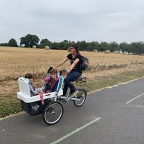
Rennes - Baie du mont Saint Michel
A cycling route starting in Saint-Grégoire, Brittany Region, France.
Overview
About this route
Rennes vers la Baie du Mont Saint Michel. Départ du nord de Rennes, pour que chacun adapte en fonctiond e son lieu de résidence.
Circuit très roulant, peu de bosses (surtout les 20 derniers kilometres!)Adaptez l'arrivée suivant votre destination : Cancale, le Vivier sur mer, etc.
- -:--
- Duration
- 70.3 km
- Distance
- 240 m
- Ascent
- 274 m
- Descent
- ---
- Avg. speed
- ---
- Max. altitude

Route quality
Waytypes & surfaces along the route
Waytypes
Road
46.8 km
(67 %)
Busy road
20.6 km
(29 %)
Surfaces
Paved
39 km
(56 %)
Asphalt
39 km
(56 %)
Undefined
31.3 km
(44 %)
Continue with Bikemap
Use, edit, or download this cycling route
You would like to ride Rennes - Baie du mont Saint Michel or customize it for your own trip? Here is what you can do with this Bikemap route:
Free features
- Save this route as favorite or in collections
- Copy & plan your own version of this route
- Sync your route with Garmin or Wahoo
Premium features
Free trial for 3 days, or one-time payment. More about Bikemap Premium.
- Navigate this route on iOS & Android
- Export a GPX / KML file of this route
- Create your custom printout (try it for free)
- Download this route for offline navigation
Discover more Premium features.
Get Bikemap PremiumFrom our community
Other popular routes starting in Saint-Grégoire
 De Rue Aurélie Nemours 1, Rennes à Quai Chateaubriand 1, Rennes
- Distance
- 4.7 km
- Ascent
- 0 m
- Descent
- 26 m
- Location
- Saint-Grégoire, Brittany Region, France
 centro de Rennes
- Distance
- 9 km
- Ascent
- 20 m
- Descent
- 52 m
- Location
- Saint-Grégoire, Brittany Region, France
 Ronde Bretagne
- Distance
- 594.4 km
- Ascent
- 4,373 m
- Descent
- 4,434 m
- Location
- Saint-Grégoire, Brittany Region, France
 30km Le long de la Vilaine
- Distance
- 30.3 km
- Ascent
- 30 m
- Descent
- 30 m
- Location
- Saint-Grégoire, Brittany Region, France
 Itinéraire facile en La Chapelle-des-Fougeretz
- Distance
- 10.9 km
- Ascent
- 112 m
- Descent
- 49 m
- Location
- Saint-Grégoire, Brittany Region, France
 De La Trudais 8, Saint-Grégoire à Chemin de la Guilbonnais 2, Cesson-Sévigné
- Distance
- 24.9 km
- Ascent
- 269 m
- Descent
- 256 m
- Location
- Saint-Grégoire, Brittany Region, France
 Tur Rennes
- Distance
- 9.8 km
- Ascent
- 66 m
- Descent
- 99 m
- Location
- Saint-Grégoire, Brittany Region, France
 Sortie test vélo
- Distance
- 54.8 km
- Ascent
- 267 m
- Descent
- 267 m
- Location
- Saint-Grégoire, Brittany Region, France
Open it in the app