All8: Sonthofen - Pfronten; 75,3km 750hm
A cycling route starting in Blaichach, Bavaria, Germany.
Overview
About this route
Sonthofen - (RRA) - Erzfröße - Burgberg - Rauhenzell - Wagneritz- Altach - Bichel - Rettenberg - Kalchenbach - Engelpolz - Emmereis - Vorderburg - Acker - Rieder - Petersthal - Memersch - Haag - Oy - Faistenoy - Wertach - Alpe Sorg 1 - Unterjoch - Steig - Wies - Innergschwend - Lumberg - Enge - Heitlern Dorf - Pfronten
Hotel Pfronten - PENSION FREIHEIT, Vilstalstraße 53, 87459 Pfronten
- -:--
- Duration
- 75.3 km
- Distance
- 957 m
- Ascent
- 825 m
- Descent
- ---
- Avg. speed
- 1,147 m
- Max. altitude
Route quality
Waytypes & surfaces along the route
Waytypes
Quiet road
30.9 km
(41 %)
Track
20.3 km
(27 %)
Surfaces
Paved
53.4 km
(71 %)
Unpaved
10.5 km
(14 %)
Asphalt
49.7 km
(66 %)
Gravel
7.5 km
(10 %)
Route highlights
Points of interest along the route

Point of interest after 10.3 km
Panoramabank am Grünten
Point of interest after 23.3 km
Panoramabank
Point of interest after 24.4 km
Badestelle Petersthal
Point of interest after 24.9 km
Wildbachtretbecken
Accommodation after 29.9 km
Gasthaus Krone nach 30 km
Point of interest after 31.7 km
Kneippgarten im Kurpark Oy Oy
Point of interest after 32.2 km
Kneippgarten am Mühlbach
Point of interest after 32.8 km
Abzweigung zur Badestelle Grüntensee - wenn kein Baden, dann geradeaus weiterfahren nach Wertach
Point of interest after 37.3 km
Badestelle Grüntensee
Point of interest after 45.2 km
Rastplatz
Point of interest after 49.6 km
Wasserfall
Point of interest after 51 km
Bänke
Point of interest after 51.6 km
Bank
Point of interest after 52.7 km
Bank
Point of interest after 53 km
Bank
Point of interest after 61.6 km
Routenfehler: links abbiegen anstelle geradeaus
Point of interest after 71.6 km
Bank

Accommodation after 75.2 km
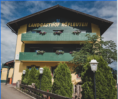
Landgasthof Röfleuten Zerlachweg 1, 87459 Pfronten
Continue with Bikemap
Use, edit, or download this cycling route
You would like to ride All8: Sonthofen - Pfronten; 75,3km 750hm or customize it for your own trip? Here is what you can do with this Bikemap route:
Free features
- Save this route as favorite or in collections
- Copy & plan your own version of this route
- Sync your route with Garmin or Wahoo
Premium features
Free trial for 3 days, or one-time payment. More about Bikemap Premium.
- Navigate this route on iOS & Android
- Export a GPX / KML file of this route
- Create your custom printout (try it for free)
- Download this route for offline navigation
Discover more Premium features.
Get Bikemap PremiumFrom our community
Other popular routes starting in Blaichach
 All8: Sonthofen - Pfronten; 75,3km 750hm
- Distance
- 75.3 km
- Ascent
- 957 m
- Descent
- 825 m
- Location
- Blaichach, Bavaria, Germany
 Rund um die Hörner
- Distance
- 68.2 km
- Ascent
- 1,510 m
- Descent
- 1,397 m
- Location
- Blaichach, Bavaria, Germany
 Grünten Freeriding CLONED FROM ROUTE 36099
- Distance
- 21.8 km
- Ascent
- 886 m
- Descent
- 887 m
- Location
- Blaichach, Bavaria, Germany
 AlpenX2009
- Distance
- 581.7 km
- Ascent
- 27,850 m
- Descent
- 27,809 m
- Location
- Blaichach, Bavaria, Germany
 Riedbergpass-Hagspiel-Oberstaufen-Alpsee
- Distance
- 89.5 km
- Ascent
- 1,445 m
- Descent
- 1,445 m
- Location
- Blaichach, Bavaria, Germany
 Von Sonthofen zur Kaeseralpe
- Distance
- 51.7 km
- Ascent
- 667 m
- Descent
- 667 m
- Location
- Blaichach, Bavaria, Germany
 Heimatblick
- Distance
- 47.7 km
- Ascent
- 1,132 m
- Descent
- 1,130 m
- Location
- Blaichach, Bavaria, Germany
 Alpsee Bergwelt
- Distance
- 38.2 km
- Ascent
- 458 m
- Descent
- 460 m
- Location
- Blaichach, Bavaria, Germany
Open it in the app


