

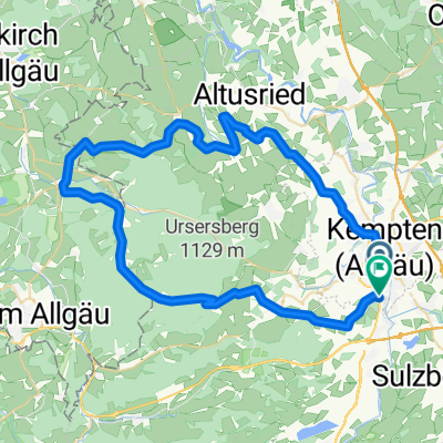
Sonntags-Katertour
A cycling route starting in Kempten (Allgäu), Bavaria, Germany.
Overview
About this route
Satte 1400 Höhenmeter insgesamt, mit paar Verfahrern 65km. Teils unbefahrbar, V.a. die Variante im Rohrbachtobel. Viel schultern an der Stelle, aber die Trails sinds wert. 22% Steigungen, flowige, schnelle Schottertrails aber auch langsame anspruchsvolle Wurzeltrails. Der absolute Höhepunkt oben am schwarzen Grat auf fast 1200m. Zum Schluss als Sahne häubchen noch übern Kalbsangsttobel vom Mariaberg runter. Harte, aber sehr schöne Tour.
- -:--
- Duration
- 53.7 km
- Distance
- 1,107 m
- Ascent
- 1,107 m
- Descent
- ---
- Avg. speed
- ---
- Avg. speed
Continue with Bikemap
Use, edit, or download this cycling route
You would like to ride Sonntags-Katertour or customize it for your own trip? Here is what you can do with this Bikemap route:
Free features
- Save this route as favorite or in collections
- Copy & plan your own version of this route
- Sync your route with Garmin or Wahoo
Premium features
Free trial for 3 days, or one-time payment. More about Bikemap Premium.
- Navigate this route on iOS & Android
- Export a GPX / KML file of this route
- Create your custom printout (try it for free)
- Download this route for offline navigation
Discover more Premium features.
Get Bikemap PremiumFrom our community
Other popular routes starting in Kempten (Allgäu)
 Sonntags-Katertour
- Distance
- 53.7 km
- Ascent
- 1,107 m
- Descent
- 1,107 m
- Location
- Kempten (Allgäu), Bavaria, Germany
 Allgäu - Wallfahrtskapellen und Einödsbauern
- Distance
- 70.4 km
- Ascent
- 0 m
- Descent
- 0 m
- Location
- Kempten (Allgäu), Bavaria, Germany
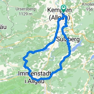
 Nord-West Runde Kempten
- Distance
- 59.3 km
- Ascent
- 656 m
- Descent
- 664 m
- Location
- Kempten (Allgäu), Bavaria, Germany
 Rund um Kempten
- Distance
- 18.4 km
- Ascent
- 143 m
- Descent
- 146 m
- Location
- Kempten (Allgäu), Bavaria, Germany
 Kempten-Jochpaß-Grän-Pfronten-Kempten
- Distance
- 106.7 km
- Ascent
- 1,185 m
- Descent
- 1,070 m
- Location
- Kempten (Allgäu), Bavaria, Germany
 diepolz rettenberg
- Distance
- 62.6 km
- Ascent
- 689 m
- Descent
- 690 m
- Location
- Kempten (Allgäu), Bavaria, Germany
 Von Kempten über Hauchenberg Niedersonthofen nach Kempten
- Distance
- 55.8 km
- Ascent
- 882 m
- Descent
- 872 m
- Location
- Kempten (Allgäu), Bavaria, Germany
 Trainingsrunde
- Distance
- 41.5 km
- Ascent
- 750 m
- Descent
- 754 m
- Location
- Kempten (Allgäu), Bavaria, Germany
Open it in the app