
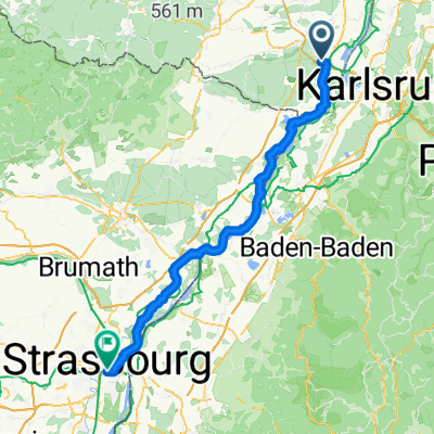
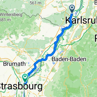
CYCLING THE RHINE: Route 17A
A cycling route starting in Wörth am Rhein, Rhineland-Palatinate, Germany.
Overview
About this route
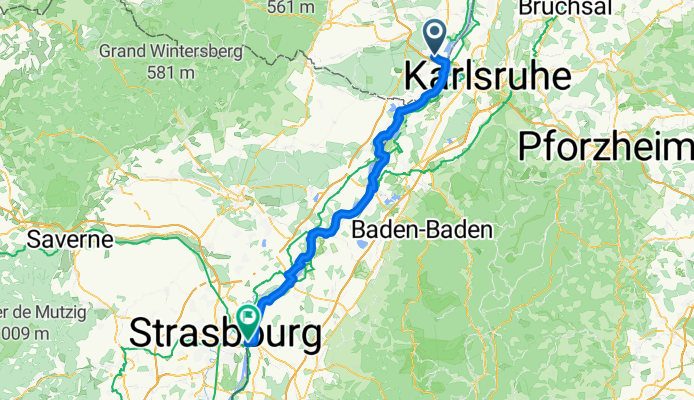
Worth am Rhein (Mitte) Railway Station to Kehl Railway Station, following the Rhine river.
NOTE: The road layout between Worth am Rhein, through Maximiliansau to the Rhine, has substantially changed and the described route (in the hard copy book) no longer applies. This map shows the updated routing in this area. Some tweaks take advantage of newer bike routes closer to the Rhine.- -:--
- Duration
- 82 km
- Distance
- 75 m
- Ascent
- 41 m
- Descent
- ---
- Avg. speed
- ---
- Max. altitude
Route quality
Waytypes & surfaces along the route
Waytypes
Track
56.6 km
(69 %)
Access road
5.7 km
(7 %)
Surfaces
Paved
33.6 km
(41 %)
Unpaved
42.6 km
(52 %)
Asphalt
32 km
(39 %)
Gravel
23 km
(28 %)
Route highlights
Points of interest along the route
Accommodation after 5.2 km
Friends of Nature site. Rheinfrieden
Point of interest after 13.1 km
Border between France and Germany.
Accommodation after 29.4 km
Guest House Anker. I have stayed here and found the service and facilities to be excellent.
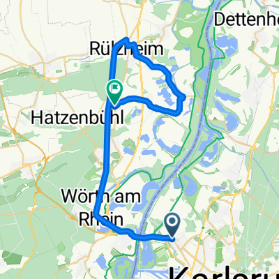
Point of interest after 65.6 km
Deviation from the described route (in the hard copy book) at this point, to take advantage of the riverside route.
Point of interest after 80.6 km
Deviation from described route (in the hard copy book) at this point, to simplify the route. Rejoin described route at corner of Konigsberger and Elbinger Strassen.
Accommodation after 82 km
YOUTH HOSTEL: DJH Kehl. Altrhrheinweg 11, Kehl I have stayed at this hostel a number of times. I can recommend the facilities and cuisine.
Accommodation after 82 km
YOUTH HOSTEL: FUAJ Strasbourg, Parc du Rhin. I have stayed at this hostel. I would not stay here again.
Continue with Bikemap
Use, edit, or download this cycling route
You would like to ride CYCLING THE RHINE: Route 17A or customize it for your own trip? Here is what you can do with this Bikemap route:
Free features
- Save this route as favorite or in collections
- Copy & plan your own version of this route
- Split it into stages to create a multi-day tour
- Sync your route with Garmin or Wahoo
Premium features
Free trial for 3 days, or one-time payment. More about Bikemap Premium.
- Navigate this route on iOS & Android
- Export a GPX / KML file of this route
- Create your custom printout (try it for free)
- Download this route for offline navigation
Discover more Premium features.
Get Bikemap PremiumFrom our community
Other popular routes starting in Wörth am Rhein
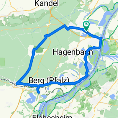 44_Wörth – Lauterbourg (F) – Wörth
- Distance
- 37.6 km
- Ascent
- 71 m
- Descent
- 71 m
- Location
- Wörth am Rhein, Rhineland-Palatinate, Germany
 Wörth am Rhein - Worms
- Distance
- 113.2 km
- Ascent
- 0 m
- Descent
- 15 m
- Location
- Wörth am Rhein, Rhineland-Palatinate, Germany
 Deutsch-Französische Maifahrt 2010 - RTF des RSC Wörth 1980 e.V. - 164 km Strecke
- Distance
- 150 km
- Ascent
- 650 m
- Descent
- 650 m
- Location
- Wörth am Rhein, Rhineland-Palatinate, Germany
 Eisenbahnstraße, Wörth am Rhein nach Route du Rhin, Gambsheim
- Distance
- 62.9 km
- Ascent
- 140 m
- Descent
- 114 m
- Location
- Wörth am Rhein, Rhineland-Palatinate, Germany
 Hanns-Martin-Schleyer-Straße, Wörth am Rhein nach Route de l'Hôpital, Straßburg
- Distance
- 84.1 km
- Ascent
- 231 m
- Descent
- 209 m
- Location
- Wörth am Rhein, Rhineland-Palatinate, Germany
 Elsassrunde
- Distance
- 60.2 km
- Ascent
- 176 m
- Descent
- 187 m
- Location
- Wörth am Rhein, Rhineland-Palatinate, Germany
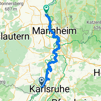
 Knielingen, Karlsruhe nach Flachsmarkt, Rheinzabern
- Distance
- 32.4 km
- Ascent
- 87 m
- Descent
- 88 m
- Location
- Wörth am Rhein, Rhineland-Palatinate, Germany
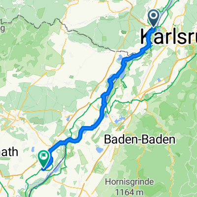
 Wörth am Rhein - Kehl
- Distance
- 77.1 km
- Ascent
- 206 m
- Descent
- 168 m
- Location
- Wörth am Rhein, Rhineland-Palatinate, Germany
Open it in the app