

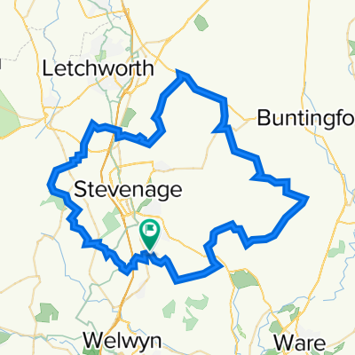
Tour de Stevenage
A cycling route starting in Knebworth, England, United Kingdom.
Overview
About this route
- -:--
- Duration
- 62.3 km
- Distance
- 547 m
- Ascent
- 548 m
- Descent
- ---
- Avg. speed
- 152 m
- Max. altitude

Route quality
Waytypes & surfaces along the route
Waytypes
Road
27.5 km
(44 %)
Quiet road
27.1 km
(44 %)
Surfaces
Paved
26.7 km
(43 %)
Unpaved
0.1 km
(<1 %)
Asphalt
25.6 km
(41 %)
Paved (undefined)
1.2 km
(2 %)
Continue with Bikemap
Use, edit, or download this cycling route
You would like to ride Tour de Stevenage or customize it for your own trip? Here is what you can do with this Bikemap route:
Free features
- Save this route as favorite or in collections
- Copy & plan your own version of this route
- Sync your route with Garmin or Wahoo
Premium features
Free trial for 3 days, or one-time payment. More about Bikemap Premium.
- Navigate this route on iOS & Android
- Export a GPX / KML file of this route
- Create your custom printout (try it for free)
- Download this route for offline navigation
Discover more Premium features.
Get Bikemap PremiumFrom our community
Other popular routes starting in Knebworth
 Chequers Inn Circuit
- Distance
- 26.7 km
- Ascent
- 187 m
- Descent
- 183 m
- Location
- Knebworth, England, United Kingdom
 test1
test1- Distance
- 2.7 km
- Ascent
- 12 m
- Descent
- 34 m
- Location
- Knebworth, England, United Kingdom
 Bragbury end to Bragbury End big circuit with punctures to boot!
- Distance
- 43.9 km
- Ascent
- 441 m
- Descent
- 442 m
- Location
- Knebworth, England, United Kingdom
 Sherrards wood loop
- Distance
- 50 km
- Ascent
- 435 m
- Descent
- 436 m
- Location
- Knebworth, England, United Kingdom
 Tour de Stevenage
- Distance
- 62.3 km
- Ascent
- 547 m
- Descent
- 548 m
- Location
- Knebworth, England, United Kingdom
 8 Ashburnham Walk, Stevenage to 5–7 Ashburnham Walk, Stevenage
- Distance
- 15.5 km
- Ascent
- 33 m
- Descent
- 46 m
- Location
- Knebworth, England, United Kingdom
 Nasty, Romans and Vogons.
- Distance
- 60.2 km
- Ascent
- 426 m
- Descent
- 432 m
- Location
- Knebworth, England, United Kingdom
 21 Hidden Hertfordshire
- Distance
- 59.5 km
- Ascent
- 394 m
- Descent
- 394 m
- Location
- Knebworth, England, United Kingdom
Open it in the app