

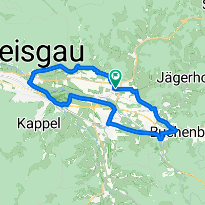
Schauinslandstraße 15, Stegen nach Elmar-Bitzenhofer-Weg, Au
A cycling route starting in Stegen, Baden-Wurttemberg, Germany.
Overview
About this route
- 54 min
- Duration
- 14.3 km
- Distance
- 58 m
- Ascent
- 138 m
- Descent
- 15.9 km/h
- Avg. speed
- 385 m
- Max. altitude

Route quality
Waytypes & surfaces along the route
Waytypes
Quiet road
2.7 km
(19 %)
Cycleway
2.7 km
(19 %)
Surfaces
Paved
13.9 km
(97 %)
Asphalt
13.9 km
(97 %)
Undefined
0.4 km
(3 %)
Continue with Bikemap
Use, edit, or download this cycling route
You would like to ride Schauinslandstraße 15, Stegen nach Elmar-Bitzenhofer-Weg, Au or customize it for your own trip? Here is what you can do with this Bikemap route:
Free features
- Save this route as favorite or in collections
- Copy & plan your own version of this route
- Sync your route with Garmin or Wahoo
Premium features
Free trial for 3 days, or one-time payment. More about Bikemap Premium.
- Navigate this route on iOS & Android
- Export a GPX / KML file of this route
- Create your custom printout (try it for free)
- Download this route for offline navigation
Discover more Premium features.
Get Bikemap PremiumFrom our community
Other popular routes starting in Stegen
 Harthausen Radklassiker
- Distance
- 91.8 km
- Ascent
- 1,244 m
- Descent
- 1,074 m
- Location
- Stegen, Baden-Wurttemberg, Germany
 Stegen-Buchenbach-Ebnet
- Distance
- 20.2 km
- Ascent
- 152 m
- Descent
- 152 m
- Location
- Stegen, Baden-Wurttemberg, Germany
 Kandelkönig am 25.7.2015
- Distance
- 60.5 km
- Ascent
- 1,292 m
- Descent
- 1,293 m
- Location
- Stegen, Baden-Wurttemberg, Germany
 Stegen - Schauinsland - Stegen
- Distance
- 44.7 km
- Ascent
- 946 m
- Descent
- 944 m
- Location
- Stegen, Baden-Wurttemberg, Germany
 Stegen-Rappenecker Hütter-Kirchzarten
- Distance
- 18.9 km
- Ascent
- 704 m
- Descent
- 708 m
- Location
- Stegen, Baden-Wurttemberg, Germany
 attental-st.peter = kurze knackige trainingsstrecke
- Distance
- 25.7 km
- Ascent
- 629 m
- Descent
- 600 m
- Location
- Stegen, Baden-Wurttemberg, Germany
 attental-st.peter/platte = anspruchsvoller anstieg
- Distance
- 37.6 km
- Ascent
- 1,011 m
- Descent
- 963 m
- Location
- Stegen, Baden-Wurttemberg, Germany
 Radtour 2015 Paris - Verdun
- Distance
- 1,325.1 km
- Ascent
- 1,234 m
- Descent
- 1,582 m
- Location
- Stegen, Baden-Wurttemberg, Germany
Open it in the app