Carretera México-Texcoco, Chimalhuacán a Temamatla - Zona Militar, Temamatla
A cycling route starting in Arenal, Estado de México, Mexico.
Overview
About this route
- 1 h 54 min
- Duration
- 33.1 km
- Distance
- 99 m
- Ascent
- 82 m
- Descent
- 17.4 km/h
- Avg. speed
- 2,291 m
- Avg. speed
Route photos
Route quality
Waytypes & surfaces along the route
Waytypes
Cycleway
12.2 km
(37 %)
Busy road
9.2 km
(28 %)
Surfaces
Paved
10.4 km
(31 %)
Unpaved
0.4 km
(1 %)
Asphalt
10.3 km
(31 %)
Ground
0.4 km
(1 %)
Continue with Bikemap
Use, edit, or download this cycling route
You would like to ride Carretera México-Texcoco, Chimalhuacán a Temamatla - Zona Militar, Temamatla or customize it for your own trip? Here is what you can do with this Bikemap route:
Free features
- Save this route as favorite or in collections
- Copy & plan your own version of this route
- Sync your route with Garmin or Wahoo
Premium features
Free trial for 3 days, or one-time payment. More about Bikemap Premium.
- Navigate this route on iOS & Android
- Export a GPX / KML file of this route
- Create your custom printout (try it for free)
- Download this route for offline navigation
Discover more Premium features.
Get Bikemap PremiumFrom our community
Other popular routes starting in Arenal
- Paseo lento en Los Reyes Acaquilpan
- Distance
- 4.3 km
- Ascent
- 109 m
- Descent
- 28 m
- Location
- Arenal, Estado de México, Mexico
- Ruta rápida en Ciudad de México
- Distance
- 32 km
- Ascent
- 247 m
- Descent
- 249 m
- Location
- Arenal, Estado de México, Mexico
- Ruta desde Avenida Coahuila LT6, Chimalhuacán
- Distance
- 27.8 km
- Ascent
- 513 m
- Descent
- 172 m
- Location
- Arenal, Estado de México, Mexico
- ejército del trabajo
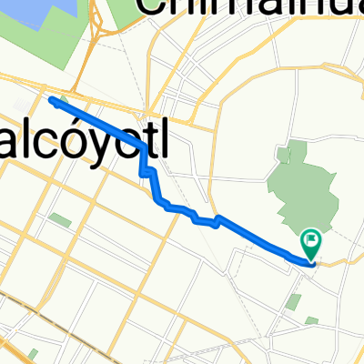
- Distance
- 7.6 km
- Ascent
- 58 m
- Descent
- 59 m
- Location
- Arenal, Estado de México, Mexico
- Ruta relajada en Tlalnepantla de Baz
- Distance
- 5.8 km
- Ascent
- 56 m
- Descent
- 41 m
- Location
- Arenal, Estado de México, Mexico
- De Carretera Federal México-Texcoco 128, Chicoloapan de Juárez a Cerrada Segunda Cerrada Toluca 4, San Juan Ixtayopan
- Distance
- 24.9 km
- Ascent
- 163 m
- Descent
- 88 m
- Location
- Arenal, Estado de México, Mexico
- Carretera México-Texcoco, Chimalhuacán a Temamatla - Zona Militar, Temamatla
- Distance
- 33.1 km
- Ascent
- 99 m
- Descent
- 82 m
- Location
- Arenal, Estado de México, Mexico
- Calle Río Grande 10, Chimalhuacán a Calle Río Grande 10, Chimalhuacán
- Distance
- 12.7 km
- Ascent
- 357 m
- Descent
- 355 m
- Location
- Arenal, Estado de México, Mexico
Open it in the app