

Spiesbrunn/Jägersteig/Pfeiferweg
A cycling route starting in Breitenberg, Bavaria, Germany.
Overview
About this route
- 1 h
- Duration
- 15.3 km
- Distance
- 244 m
- Ascent
- 243 m
- Descent
- 15.4 km/h
- Avg. speed
- 828 m
- Max. altitude

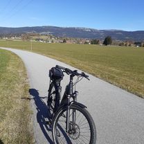
Route photos


Route quality
Waytypes & surfaces along the route
Waytypes
Quiet road
10.3 km
(67 %)
Busy road
2.1 km
(14 %)
Surfaces
Paved
7.8 km
(51 %)
Unpaved
0.6 km
(4 %)
Asphalt
7.8 km
(51 %)
Gravel
0.6 km
(4 %)
Undefined
6.9 km
(45 %)
Continue with Bikemap
Use, edit, or download this cycling route
You would like to ride Spiesbrunn/Jägersteig/Pfeiferweg or customize it for your own trip? Here is what you can do with this Bikemap route:
Free features
- Save this route as favorite or in collections
- Copy & plan your own version of this route
- Sync your route with Garmin or Wahoo
Premium features
Free trial for 3 days, or one-time payment. More about Bikemap Premium.
- Navigate this route on iOS & Android
- Export a GPX / KML file of this route
- Create your custom printout (try it for free)
- Download this route for offline navigation
Discover more Premium features.
Get Bikemap PremiumFrom our community
Other popular routes starting in Breitenberg
 Spiesbrunnweg, Stüblhäuser, Rastbüchlstr., Kleingsenget, Ungarsteig, Wegscheiderstr.
- Distance
- 20.9 km
- Ascent
- 322 m
- Descent
- 369 m
- Location
- Breitenberg, Bavaria, Germany
 Dreihiaslstr. Bräuerau, Seitelschlag, Hinteranger
- Distance
- 19.3 km
- Ascent
- 242 m
- Descent
- 266 m
- Location
- Breitenberg, Bavaria, Germany
 Grenzstrasse, Seitelschlag, Kohlstatt
- Distance
- 21.5 km
- Ascent
- 327 m
- Descent
- 354 m
- Location
- Breitenberg, Bavaria, Germany
 Gollnerbergstraße 24, Breitenberg nach Gollnerbergstraße 24, Breitenberg
- Distance
- 24.6 km
- Ascent
- 845 m
- Descent
- 845 m
- Location
- Breitenberg, Bavaria, Germany
 Leinenradweg
- Distance
- 42.5 km
- Ascent
- 619 m
- Descent
- 697 m
- Location
- Breitenberg, Bavaria, Germany
 Spiesbrunn/Jägersteig/Pfeiferweg
- Distance
- 15.3 km
- Ascent
- 244 m
- Descent
- 243 m
- Location
- Breitenberg, Bavaria, Germany
 Grenzstrasse, Sagberg, Hochkraml, Vorderschiffl, Kohlstatt
- Distance
- 20.6 km
- Ascent
- 347 m
- Descent
- 385 m
- Location
- Breitenberg, Bavaria, Germany
 Schwarzenberg Böhmerwald
- Distance
- 22.9 km
- Ascent
- 276 m
- Descent
- 327 m
- Location
- Breitenberg, Bavaria, Germany
Open it in the app