Giens - La Londe - Pierrefeu - Cuers - La Crau - Hyères - Giens
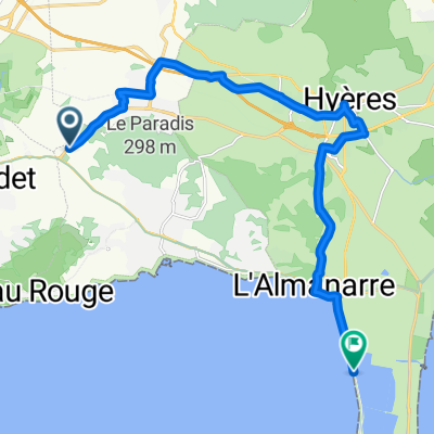
A cycling route starting in Carqueiranne, Provence-Alpes-Côte d'Azur Region, France.
Overview
About this route
- -:--
- Duration
- 79.3 km
- Distance
- 379 m
- Ascent
- 379 m
- Descent
- ---
- Avg. speed
- ---
- Avg. speed
Route quality
Waytypes & surfaces along the route
Waytypes
Busy road
32.8 km
(41 %)
Road
32 km
(40 %)
Surfaces
Paved
55.2 km
(70 %)
Asphalt
54.7 km
(69 %)
Concrete
0.5 km
(<1 %)
Undefined
24 km
(30 %)
Continue with Bikemap
Use, edit, or download this cycling route
You would like to ride Giens - La Londe - Pierrefeu - Cuers - La Crau - Hyères - Giens or customize it for your own trip? Here is what you can do with this Bikemap route:
Free features
- Save this route as favorite or in collections
- Copy & plan your own version of this route
- Sync your route with Garmin or Wahoo
Premium features
Free trial for 3 days, or one-time payment. More about Bikemap Premium.
- Navigate this route on iOS & Android
- Export a GPX / KML file of this route
- Create your custom printout (try it for free)
- Download this route for offline navigation
Discover more Premium features.
Get Bikemap PremiumFrom our community
Other popular routes starting in Carqueiranne
- 2015_09_02 Tour in Südfrankreich
- Distance
- 128.6 km
- Ascent
- 1,552 m
- Descent
- 1,552 m
- Location
- Carqueiranne, Provence-Alpes-Côte d'Azur Region, France
- V65 - Parcours cyclable du littoral
- Distance
- 49.8 km
- Ascent
- 338 m
- Descent
- 321 m
- Location
- Carqueiranne, Provence-Alpes-Côte d'Azur Region, France
- 1. Etappe zum Einrollen
- Distance
- 64.6 km
- Ascent
- 400 m
- Descent
- 403 m
- Location
- Carqueiranne, Provence-Alpes-Côte d'Azur Region, France
- Recovered Route
- Distance
- 37 km
- Ascent
- 0 m
- Descent
- 6 m
- Location
- Carqueiranne, Provence-Alpes-Côte d'Azur Region, France
- Giens - La Londe - Pierrefeu - Cuers - La Crau - Hyères - Giens
- Distance
- 79.3 km
- Ascent
- 379 m
- Descent
- 379 m
- Location
- Carqueiranne, Provence-Alpes-Côte d'Azur Region, France
- BHF - Camping
- Distance
- 11.2 km
- Ascent
- 66 m
- Descent
- 62 m
- Location
- Carqueiranne, Provence-Alpes-Côte d'Azur Region, France
- TL 2011: 2. Etappe: Col de Bababou
- Distance
- 99.6 km
- Ascent
- 581 m
- Descent
- 581 m
- Location
- Carqueiranne, Provence-Alpes-Côte d'Azur Region, France
- YLP6
- Distance
- 39.1 km
- Ascent
- 672 m
- Descent
- 671 m
- Location
- Carqueiranne, Provence-Alpes-Côte d'Azur Region, France
Open it in the app