

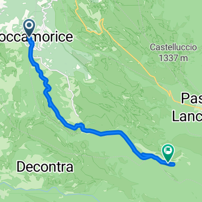
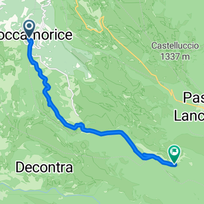
Roccamorice Eremo di San Bartolomeo
A cycling route starting in Roccamorice, Abruzzo, Italy.
Overview
About this route
the hermitage of San Bartolomeo is one of the most spectacular and famous Celestinian hermitages in the Majella. It was built around 1250 on a pre-existing structure by Pope Celestine V. It features a coloration that is completely homogeneous to the rocks that encase it. The church and two small rooms for the hermits rise above the rocky terrace accessed via four staircases: one to the north, consisting of 30 irregular steps carved directly into the rock, one to the south, also carved from the rock, but longer and more irregular, and finally two in the center of the balcony, one of which served as a Scala Santa. The church's facade bears traces of a fresco depicting, in the lower part, an ostensorium and, in the upper part, two panels with Christ and a Madonna with Child. The interior is illuminated by a door-window. Along the left wall, there is a small spring of water, which, through a small channel, flows outside the church and loses itself in the rock. This water, considered holy, once mixed with the water from the spring beneath the hermitage, is collected in the holy water font.
- -:--
- Duration
- 9.4 km
- Distance
- 205 m
- Ascent
- 464 m
- Descent
- ---
- Avg. speed
- 839 m
- Max. altitude
Route photos

Route quality
Waytypes & surfaces along the route
Waytypes
Road
4.2 km
(45 %)
Track
3 km
(32 %)
Surfaces
Paved
4.6 km
(49 %)
Unpaved
2.2 km
(23 %)
Asphalt
4.6 km
(49 %)
Ground
2.2 km
(23 %)
Undefined
2.6 km
(28 %)
Continue with Bikemap
Use, edit, or download this cycling route
You would like to ride Roccamorice Eremo di San Bartolomeo or customize it for your own trip? Here is what you can do with this Bikemap route:
Free features
- Save this route as favorite or in collections
- Copy & plan your own version of this route
- Sync your route with Garmin or Wahoo
Premium features
Free trial for 3 days, or one-time payment. More about Bikemap Premium.
- Navigate this route on iOS & Android
- Export a GPX / KML file of this route
- Create your custom printout (try it for free)
- Download this route for offline navigation
Discover more Premium features.
Get Bikemap PremiumFrom our community
Other popular routes starting in Roccamorice
 Da Via de Horatiis a SP64
- Distance
- 10.8 km
- Ascent
- 760 m
- Descent
- 185 m
- Location
- Roccamorice, Abruzzo, Italy
 Roccamorice Eremo di San Bartolomeo
- Distance
- 9.4 km
- Ascent
- 205 m
- Descent
- 464 m
- Location
- Roccamorice, Abruzzo, Italy
 Da Caramanico Terme, Sant'Elia a Contrada Case Tobia
- Distance
- 11.2 km
- Ascent
- 190 m
- Descent
- 196 m
- Location
- Roccamorice, Abruzzo, Italy
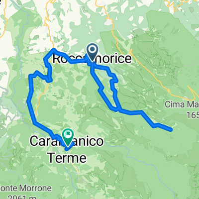 Roccamorice - Caramanico Terme
- Distance
- 37.8 km
- Ascent
- 1,409 m
- Descent
- 1,349 m
- Location
- Roccamorice, Abruzzo, Italy
 Scalata del Blockhaus versante Roccamorice
- Distance
- 12.9 km
- Ascent
- 1,111 m
- Descent
- 5 m
- Location
- Roccamorice, Abruzzo, Italy
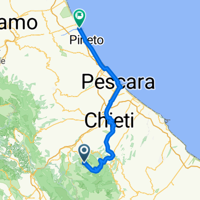 Abruzzen '09 Tour 3: zum Giro auf den Passo Lanciano, via Chieti und Pescara nach Scerne
- Distance
- 86.1 km
- Ascent
- 737 m
- Descent
- 1,488 m
- Location
- Roccamorice, Abruzzo, Italy
 Percorso per SP64
- Distance
- 10.8 km
- Ascent
- 760 m
- Descent
- 185 m
- Location
- Roccamorice, Abruzzo, Italy
 T - Gli eremi della Majella 1
- Distance
- 13.7 km
- Ascent
- 593 m
- Descent
- 597 m
- Location
- Roccamorice, Abruzzo, Italy
Open it in the app