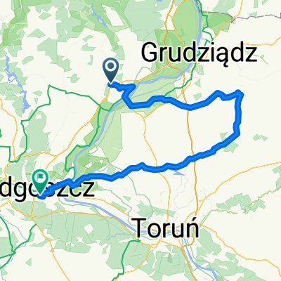
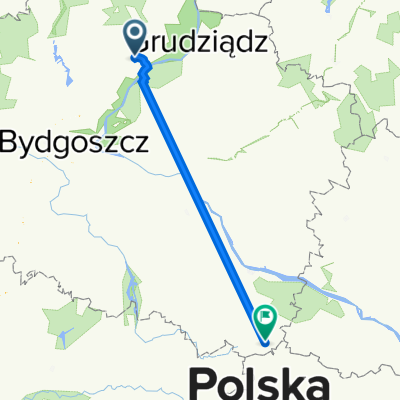
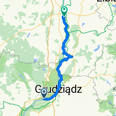
tlen z mężem
A cycling route starting in Gmina Świecie, Kujawsko-Pomorskie Voivodship, Poland.
Overview
About this route
- 6 h 46 min
- Duration
- 65.3 km
- Distance
- 700 m
- Ascent
- 668 m
- Descent
- 9.7 km/h
- Avg. speed
- 196 m
- Max. altitude
Route photos
Route quality
Waytypes & surfaces along the route
Waytypes
Road
35.3 km
(54 %)
Track
10.4 km
(16 %)
Surfaces
Paved
37.2 km
(57 %)
Unpaved
3.3 km
(5 %)
Asphalt
37.2 km
(57 %)
Ground
3.3 km
(5 %)
Undefined
24.8 km
(38 %)
Continue with Bikemap
Use, edit, or download this cycling route
You would like to ride tlen z mężem or customize it for your own trip? Here is what you can do with this Bikemap route:
Free features
- Save this route as favorite or in collections
- Copy & plan your own version of this route
- Sync your route with Garmin or Wahoo
Premium features
Free trial for 3 days, or one-time payment. More about Bikemap Premium.
- Navigate this route on iOS & Android
- Export a GPX / KML file of this route
- Create your custom printout (try it for free)
- Download this route for offline navigation
Discover more Premium features.
Get Bikemap PremiumFrom our community
Other popular routes starting in Gmina Świecie
- Terespol Pom.-Świecie-Radzyń Chełm.-Wąbrzeźno-Chełmża-Ostromecko-Bydgoszcz
- Distance
- 137.9 km
- Ascent
- 243 m
- Descent
- 235 m
- Location
- Gmina Świecie, Kujawsko-Pomorskie Voivodship, Poland
- Marszałka Józefa Piłsudskiego 25, Świecie do Marszałka Józefa Piłsudskiego 13A, Świecie
- Distance
- 7.5 km
- Ascent
- 26 m
- Descent
- 25 m
- Location
- Gmina Świecie, Kujawsko-Pomorskie Voivodship, Poland
- Świecie Zamek- Grudziądz "Camping 134"
- Distance
- 36.9 km
- Ascent
- 115 m
- Descent
- 111 m
- Location
- Gmina Świecie, Kujawsko-Pomorskie Voivodship, Poland
- MAJÓWKA 2013
- Distance
- 214 km
- Ascent
- 401 m
- Descent
- 294 m
- Location
- Gmina Świecie, Kujawsko-Pomorskie Voivodship, Poland
- I czesc
- Distance
- 40.9 km
- Ascent
- 115 m
- Descent
- 116 m
- Location
- Gmina Świecie, Kujawsko-Pomorskie Voivodship, Poland
- Kaszuby całość
- Distance
- 423.9 km
- Ascent
- 521 m
- Descent
- 522 m
- Location
- Gmina Świecie, Kujawsko-Pomorskie Voivodship, Poland
- Ehrentahl
- Distance
- 9.5 km
- Ascent
- 5 m
- Descent
- 4 m
- Location
- Gmina Świecie, Kujawsko-Pomorskie Voivodship, Poland
- Pętla Leosie
- Distance
- 49.2 km
- Ascent
- 264 m
- Descent
- 265 m
- Location
- Gmina Świecie, Kujawsko-Pomorskie Voivodship, Poland
Open it in the app