2011.06.02 - National Championships Costa Rica T.T.
A cycling route starting in Pocosol, Provincia de Alajuela, Costa Rica.
Overview
About this route
National Championships of Costa Rica [I.T.T.]
40.1 Km.
- -:--
- Duration
- 40.1 km
- Distance
- 113 m
- Ascent
- 120 m
- Descent
- ---
- Avg. speed
- ---
- Avg. speed
Route quality
Waytypes & surfaces along the route
Waytypes
Busy road
30 km
(75 %)
Quiet road
8.4 km
(21 %)
Surfaces
Paved
30.6 km
(76 %)
Unpaved
0.7 km
(2 %)
Asphalt
30.6 km
(76 %)
Unpaved (undefined)
0.7 km
(2 %)
Undefined
8.8 km
(22 %)
Continue with Bikemap
Use, edit, or download this cycling route
You would like to ride 2011.06.02 - National Championships Costa Rica T.T. or customize it for your own trip? Here is what you can do with this Bikemap route:
Free features
- Save this route as favorite or in collections
- Copy & plan your own version of this route
- Sync your route with Garmin or Wahoo
Premium features
Free trial for 3 days, or one-time payment. More about Bikemap Premium.
- Navigate this route on iOS & Android
- Export a GPX / KML file of this route
- Create your custom printout (try it for free)
- Download this route for offline navigation
Discover more Premium features.
Get Bikemap PremiumFrom our community
Other popular routes starting in Pocosol
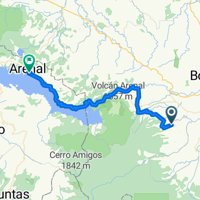
- Lago Arenal ida y vuelta desde Poder
- Distance
- 70.9 km
- Ascent
- 743 m
- Descent
- 743 m
- Location
- Pocosol, Provincia de Alajuela, Costa Rica
- 2011.06.02 - National Championships Costa Rica T.T.
- Distance
- 40.1 km
- Ascent
- 113 m
- Descent
- 120 m
- Location
- Pocosol, Provincia de Alajuela, Costa Rica
- Preparatorio inclinado
- Distance
- 3 km
- Ascent
- 496 m
- Descent
- 242 m
- Location
- Pocosol, Provincia de Alajuela, Costa Rica
- poder
- Distance
- 14.9 km
- Ascent
- 334 m
- Descent
- 368 m
- Location
- Pocosol, Provincia de Alajuela, Costa Rica
- Tigra
- Distance
- 12.9 km
- Ascent
- 211 m
- Descent
- 185 m
- Location
- Pocosol, Provincia de Alajuela, Costa Rica
- poder 2
- Distance
- 55.2 km
- Ascent
- 542 m
- Descent
- 542 m
- Location
- Pocosol, Provincia de Alajuela, Costa Rica
- Recovered Route
- Distance
- 12.2 km
- Ascent
- 512 m
- Descent
- 357 m
- Location
- Pocosol, Provincia de Alajuela, Costa Rica
- De Calle La Amistad a Carretera Invu, Colonial Trinidad
- Distance
- 5.6 km
- Ascent
- 25 m
- Descent
- 203 m
- Location
- Pocosol, Provincia de Alajuela, Costa Rica
Open it in the app