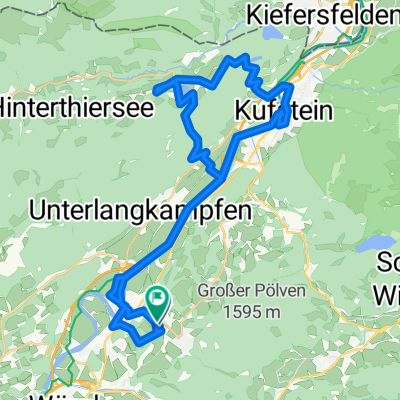
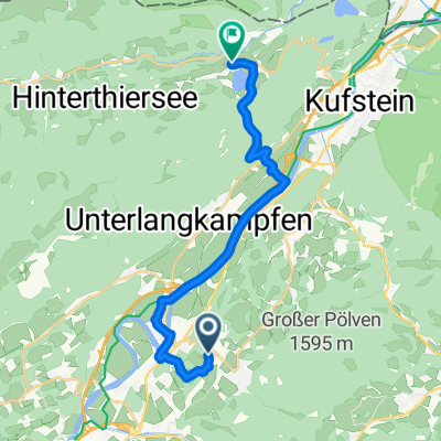
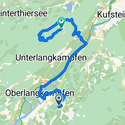
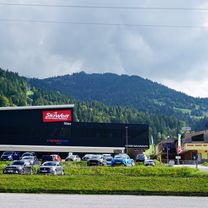
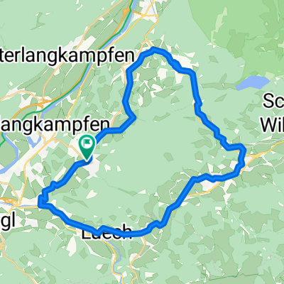
Pöven Trail - Lengauer Steig unterer Teil
A cycling route starting in Bad Häring, Tyrol, Austria.
Overview
About this route
The ascent is nice - the downhill is extremely steep and sometimes also dangerous. You need to have some technical riding skills; otherwise, it’s better to push just in case. The last 100 vertical meters will then be flatter and significantly faster.
- -:--
- Duration
- 7.6 km
- Distance
- 693 m
- Ascent
- 689 m
- Descent
- ---
- Avg. speed
- ---
- Max. altitude
Continue with Bikemap
Use, edit, or download this cycling route
You would like to ride Pöven Trail - Lengauer Steig unterer Teil or customize it for your own trip? Here is what you can do with this Bikemap route:
Free features
- Save this route as favorite or in collections
- Copy & plan your own version of this route
- Sync your route with Garmin or Wahoo
Premium features
Free trial for 3 days, or one-time payment. More about Bikemap Premium.
- Navigate this route on iOS & Android
- Export a GPX / KML file of this route
- Create your custom printout (try it for free)
- Download this route for offline navigation
Discover more Premium features.
Get Bikemap PremiumFrom our community
Other popular routes starting in Bad Häring
- Weinbergerhaus / Brentenjoch Trail
- Distance
- 42.9 km
- Ascent
- 989 m
- Descent
- 989 m
- Location
- Bad Häring, Tyrol, Austria
- Bad Häring - Rattenberg - Kramsach - Museum Tiroler Bauernhöfe (mit Kirchtag)
- Distance
- 58.9 km
- Ascent
- 452 m
- Descent
- 452 m
- Location
- Bad Häring, Tyrol, Austria
- kirchbichl-umrathshausen
- Distance
- 55.6 km
- Ascent
- 443 m
- Descent
- 340 m
- Location
- Bad Häring, Tyrol, Austria
- Kirchbichl-Achenbrenner -KaindlhĂĽtte-Waller Alm-Kirchbichl
- Distance
- 41.2 km
- Ascent
- 1,216 m
- Descent
- 1,218 m
- Location
- Bad Häring, Tyrol, Austria
- B.H. - Eiberg - Hintersteinersee - Söll - B.H.
- Distance
- 40.8 km
- Ascent
- 858 m
- Descent
- 858 m
- Location
- Bad Häring, Tyrol, Austria
- Hintersteinersee
- Distance
- 43.4 km
- Ascent
- 760 m
- Descent
- 767 m
- Location
- Bad Häring, Tyrol, Austria
- Bad Häring - Buchacker
- Distance
- 32.6 km
- Ascent
- 1,004 m
- Descent
- 1,007 m
- Location
- Bad Häring, Tyrol, Austria
- 12. Etappe der Italientour
- Distance
- 182.7 km
- Ascent
- 667 m
- Descent
- 934 m
- Location
- Bad Häring, Tyrol, Austria
Open it in the app