

Eygurande-et-Gardedeuil - Saint-Michel-de-Montaigne - Eygurande-et-Gardedeuil
A cycling route starting in Ménesplet, Nouvelle-Aquitaine, France.
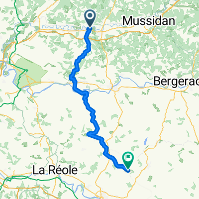
Overview
About this route
Een pittig ritje. Toch maar even stoppen voor een koffiestop! Dit is een fietsroute over verharde wegen. Bewonder zeker ook eens de bezienswaardigheden langs deze route (o.a. Noordelijk halfrond). Deze route is vrij heuvelachtig.
- -:--
- Duration
- 81.7 km
- Distance
- 927 m
- Ascent
- 928 m
- Descent
- ---
- Avg. speed
- 117 m
- Max. altitude

Route quality
Waytypes & surfaces along the route
Waytypes
Quiet road
67.6 km
(83 %)
Road
11.1 km
(14 %)
Surfaces
Paved
29.8 km
(36 %)
Asphalt
29.8 km
(36 %)
Undefined
52 km
(64 %)
Continue with Bikemap
Use, edit, or download this cycling route
You would like to ride Eygurande-et-Gardedeuil - Saint-Michel-de-Montaigne - Eygurande-et-Gardedeuil or customize it for your own trip? Here is what you can do with this Bikemap route:
Free features
- Save this route as favorite or in collections
- Copy & plan your own version of this route
- Split it into stages to create a multi-day tour
- Sync your route with Garmin or Wahoo
Premium features
Free trial for 3 days, or one-time payment. More about Bikemap Premium.
- Navigate this route on iOS & Android
- Export a GPX / KML file of this route
- Create your custom printout (try it for free)
- Download this route for offline navigation
Discover more Premium features.
Get Bikemap PremiumFrom our community
Other popular routes starting in Ménesplet
 Ménesplet - Miramont-de-Guyenne
- Distance
- 76.2 km
- Ascent
- 826 m
- Descent
- 732 m
- Location
- Ménesplet, Nouvelle-Aquitaine, France
 Quick bike tour through Montpon-Ménestérol
- Distance
- 0.3 km
- Ascent
- 0 m
- Descent
- 0 m
- Location
- Ménesplet, Nouvelle-Aquitaine, France
 Véloroute voie verte de la Vallée de l'Isle
- Distance
- 683.2 km
- Ascent
- 665 m
- Descent
- 616 m
- Location
- Ménesplet, Nouvelle-Aquitaine, France
 Eygurande-et-Gardedeuil - Saint-Michel-de-Montaigne - Eygurande-et-Gardedeuil
- Distance
- 81.7 km
- Ascent
- 927 m
- Descent
- 928 m
- Location
- Ménesplet, Nouvelle-Aquitaine, France
Open it in the app