

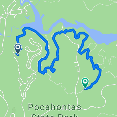
Long Forest Trail, Chesterfield a Long Forest Trail, Chesterfield
A cycling route starting in Chesterfield, Virginia, United States.
Overview
About this route
- 1 h 41 min
- Duration
- 15.9 km
- Distance
- 300 m
- Ascent
- 287 m
- Descent
- 9.5 km/h
- Avg. speed
- 92 m
- Max. altitude

Route quality
Waytypes & surfaces along the route
Waytypes
Path
10.7 km
(67 %)
Track
4.9 km
(31 %)
Access road
0.3 km
(2 %)
Surfaces
Unpaved
15.6 km
(98 %)
Ground
8.8 km
(55 %)
Gravel
4.9 km
(31 %)
Continue with Bikemap
Use, edit, or download this cycling route
You would like to ride Long Forest Trail, Chesterfield a Long Forest Trail, Chesterfield or customize it for your own trip? Here is what you can do with this Bikemap route:
Free features
- Save this route as favorite or in collections
- Copy & plan your own version of this route
- Sync your route with Garmin or Wahoo
Premium features
Free trial for 3 days, or one-time payment. More about Bikemap Premium.
- Navigate this route on iOS & Android
- Export a GPX / KML file of this route
- Create your custom printout (try it for free)
- Download this route for offline navigation
Discover more Premium features.
Get Bikemap PremiumFrom our community
Other popular routes starting in Chesterfield
 Long Forest Trail, Chesterfield a Long Forest Trail, Chesterfield
- Distance
- 15.9 km
- Ascent
- 300 m
- Descent
- 287 m
- Location
- Chesterfield, Virginia, United States
 Steady ride in Chesterfield
- Distance
- 21.4 km
- Ascent
- 196 m
- Descent
- 205 m
- Location
- Chesterfield, Virginia, United States
 Easy ride in Chesterfield
- Distance
- 16.3 km
- Ascent
- 0 m
- Descent
- 13 m
- Location
- Chesterfield, Virginia, United States
 Old Mill Bike Trail, Chesterfield to Old Mill Bike Trail, Chesterfield
- Distance
- 6.2 km
- Ascent
- 196 m
- Descent
- 182 m
- Location
- Chesterfield, Virginia, United States
 Long Forest Trail, Chesterfield a Long Forest Trail, Chesterfield
- Distance
- 6.3 km
- Ascent
- 82 m
- Descent
- 90 m
- Location
- Chesterfield, Virginia, United States
 6419 Phobus Dr, North Chesterfield to 6419 Phobus Dr, North Chesterfield
- Distance
- 6.1 km
- Ascent
- 26 m
- Descent
- 29 m
- Location
- Chesterfield, Virginia, United States
 Moderate route in Chesterfield
- Distance
- 10.4 km
- Ascent
- 164 m
- Descent
- 152 m
- Location
- Chesterfield, Virginia, United States
 Pocahontas ride 1st day
- Distance
- 117.2 km
- Ascent
- 308 m
- Descent
- 309 m
- Location
- Chesterfield, Virginia, United States
Open it in the app