

日本遺産 鯖街道の最短かつ最古のルート 針畑越え~古代から食を届けた街道の険しさと美しさを体感する~
A cycling route starting in Kamigyō-ku, Kyoto, Japan.
Overview
About this route
- -:--
- Duration
- 88.6 km
- Distance
- 3,204 m
- Ascent
- 3,254 m
- Descent
- ---
- Avg. speed
- 819 m
- Max. altitude

Route quality
Waytypes & surfaces along the route
Waytypes
Quiet road
26.6 km
(30 %)
Cycleway
10.6 km
(12 %)
Surfaces
Paved
81.5 km
(92 %)
Paved (undefined)
52.2 km
(59 %)
Asphalt
29.2 km
(33 %)
Undefined
7.1 km
(8 %)
Continue with Bikemap
Use, edit, or download this cycling route
You would like to ride 日本遺産 鯖街道の最短かつ最古のルート 針畑越え~古代から食を届けた街道の険しさと美しさを体感する~ or customize it for your own trip? Here is what you can do with this Bikemap route:
Free features
- Save this route as favorite or in collections
- Copy & plan your own version of this route
- Split it into stages to create a multi-day tour
- Sync your route with Garmin or Wahoo
Premium features
Free trial for 3 days, or one-time payment. More about Bikemap Premium.
- Navigate this route on iOS & Android
- Export a GPX / KML file of this route
- Create your custom printout (try it for free)
- Download this route for offline navigation
Discover more Premium features.
Get Bikemap PremiumFrom our community
Other popular routes starting in Kamigyō-ku
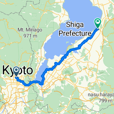 Kamigyō-ku - Hikone
- Distance
- 80.6 km
- Ascent
- 433 m
- Descent
- 410 m
- Location
- Kamigyō-ku, Kyoto, Japan
 kyoto to osaka
- Distance
- 50.7 km
- Ascent
- 144 m
- Descent
- 232 m
- Location
- Kamigyō-ku, Kyoto, Japan
 北白川追分町, 京都市左京区 to 東丸太町18-1, 京都市左京区
- Distance
- 18.1 km
- Ascent
- 539 m
- Descent
- 560 m
- Location
- Kamigyō-ku, Kyoto, Japan
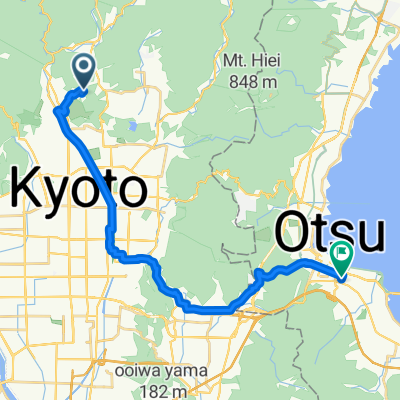 上賀茂本山, 京都市へ本宮1丁目, 大津市
- Distance
- 22.6 km
- Ascent
- 304 m
- Descent
- 356 m
- Location
- Kamigyō-ku, Kyoto, Japan
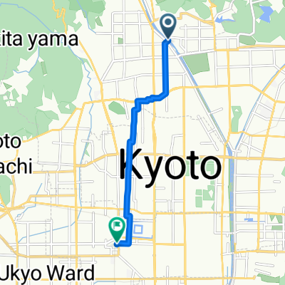 亀岡行き 二条駅迄
- Distance
- 6.2 km
- Ascent
- 0 m
- Descent
- 42 m
- Location
- Kamigyō-ku, Kyoto, Japan
 Projet Japon 2014 : Kyoto - Hiroshima
- Distance
- 626.6 km
- Ascent
- 1,992 m
- Descent
- 2,045 m
- Location
- Kamigyō-ku, Kyoto, Japan
 Kyoto to Nagahama
- Distance
- 90.6 km
- Ascent
- 194 m
- Descent
- 160 m
- Location
- Kamigyō-ku, Kyoto, Japan
 17−17, Kyoto to 7−48, Obama
- Distance
- 85 km
- Ascent
- 1,077 m
- Descent
- 1,183 m
- Location
- Kamigyō-ku, Kyoto, Japan
Open it in the app