

Noble New Franken BayShore Nicolet 26
A cycling route starting in Green Bay, Wisconsin, United States.
Overview
About this route
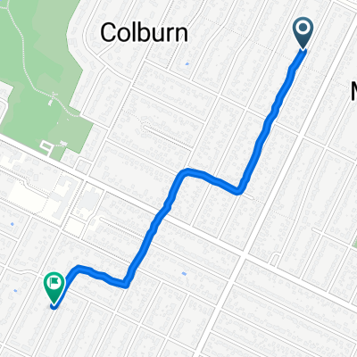
Noble-Humboldt-NewFranken-BayshorePark-Nicolet
- -:--
- Duration
- 41.4 km
- Distance
- 138 m
- Ascent
- 137 m
- Descent
- ---
- Avg. speed
- 255 m
- Max. altitude
Route quality
Waytypes & surfaces along the route
Waytypes
Quiet road
16.1 km
(39 %)
Road
9.1 km
(22 %)
Surfaces
Paved
1.7 km
(4 %)
Asphalt
1.7 km
(4 %)
Undefined
39.8 km
(96 %)
Continue with Bikemap
Use, edit, or download this cycling route
You would like to ride Noble New Franken BayShore Nicolet 26 or customize it for your own trip? Here is what you can do with this Bikemap route:
Free features
- Save this route as favorite or in collections
- Copy & plan your own version of this route
- Sync your route with Garmin or Wahoo
Premium features
Free trial for 3 days, or one-time payment. More about Bikemap Premium.
- Navigate this route on iOS & Android
- Export a GPX / KML file of this route
- Create your custom printout (try it for free)
- Download this route for offline navigation
Discover more Premium features.
Get Bikemap PremiumFrom our community
Other popular routes starting in Green Bay
 Lengthy bike tour through Green Bay
- Distance
- 56 km
- Ascent
- 233 m
- Descent
- 234 m
- Location
- Green Bay, Wisconsin, United States
 S.B.E.C. west side trail continued
- Distance
- 1.2 km
- Ascent
- 4 m
- Descent
- 6 m
- Location
- Green Bay, Wisconsin, United States
 1112 Reber St, Green Bay to 1112 Reber St, Green Bay
- Distance
- 16.2 km
- Ascent
- 86 m
- Descent
- 81 m
- Location
- Green Bay, Wisconsin, United States
 Long ride through Green Bay
- Distance
- 314 km
- Ascent
- 523 m
- Descent
- 523 m
- Location
- Green Bay, Wisconsin, United States
 842 Colonial Ave, Green Bay to 1508 Frank St, Green Bay
- Distance
- 1.4 km
- Ascent
- 0 m
- Descent
- 28 m
- Location
- Green Bay, Wisconsin, United States
 1495–1499 E Walnut St, Green Bay to 1119 E Walnut St, Green Bay
- Distance
- 11.2 km
- Ascent
- 360 m
- Descent
- 361 m
- Location
- Green Bay, Wisconsin, United States
 route 1
- Distance
- 6.2 km
- Ascent
- 81 m
- Descent
- 84 m
- Location
- Green Bay, Wisconsin, United States
 etappe 27a
- Distance
- 63.6 km
- Ascent
- 240 m
- Descent
- 241 m
- Location
- Green Bay, Wisconsin, United States
Open it in the app