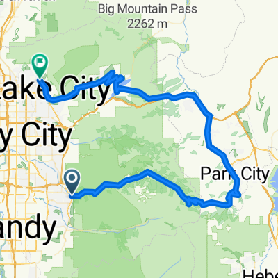
Alpine Cascade Springs Jordanelle Parleys Emigration
A cycling route starting in Cottonwood Heights, Utah, United States of America.
Overview
About this route
- -:--
- Duration
- 169.8 km
- Distance
- 2,728 m
- Ascent
- 2,725 m
- Descent
- ---
- Avg. speed
- 2,461 m
- Avg. speed
Route quality
Waytypes & surfaces along the route
Waytypes
Undefined
169.8 km
(100 %)
Surfaces
Undefined
169.8 km
(100 %)
Continue with Bikemap
Use, edit, or download this cycling route
You would like to ride Alpine Cascade Springs Jordanelle Parleys Emigration or customize it for your own trip? Here is what you can do with this Bikemap route:
Free features
- Save this route as favorite or in collections
- Copy & plan your own version of this route
- Sync your route with Garmin or Wahoo
Premium features
Free trial for 3 days, or one-time payment. More about Bikemap Premium.
- Navigate this route on iOS & Android
- Export a GPX / KML file of this route
- Create your custom printout (try it for free)
- Download this route for offline navigation
Discover more Premium features.
Get Bikemap PremiumFrom our community
Other popular routes starting in Cottonwood Heights
- Alpine Cascade Pine Canyon Loop
- Distance
- 131.6 km
- Ascent
- 3,290 m
- Descent
- 3,290 m
- Location
- Cottonwood Heights, Utah, United States of America
- parleys guardsmans
- Distance
- 91.8 km
- Ascent
- 1,659 m
- Descent
- 1,631 m
- Location
- Cottonwood Heights, Utah, United States of America
- Add on to beautiful neighborhood route
- Distance
- 6.6 km
- Ascent
- 94 m
- Descent
- 97 m
- Location
- Cottonwood Heights, Utah, United States of America
- Alpine Cascade Springs Pine Canyon Parleys Emigration
- Distance
- 171.2 km
- Ascent
- 3,368 m
- Descent
- 3,368 m
- Location
- Cottonwood Heights, Utah, United States of America
- Butler Route
- Distance
- 5.6 km
- Ascent
- 85 m
- Descent
- 86 m
- Location
- Cottonwood Heights, Utah, United States of America
- loopy
- Distance
- 114.6 km
- Ascent
- 2,136 m
- Descent
- 2,131 m
- Location
- Cottonwood Heights, Utah, United States of America
- Wasatch Blvd
- Distance
- 15.6 km
- Ascent
- 238 m
- Descent
- 238 m
- Location
- Cottonwood Heights, Utah, United States of America
- Butler Reverse
- Distance
- 7.4 km
- Ascent
- 77 m
- Descent
- 74 m
- Location
- Cottonwood Heights, Utah, United States of America