

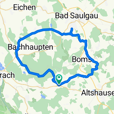
Rund um Hoßkirch - Atshausen und Saulgau CLONED FROM ROUTE 94231
A cycling route starting in Hoßkirch, Baden-Württemberg, Germany.
Overview
About this route
Hauptsächlich Asphaltwege mit einen Schotterstücken im Wagenhartwald. Leicht Hügelig Fahrzeit ca 1,5 bis 2 Stunden. Kaum / wenig Waldgebiete
- -:--
- Duration
- 30 km
- Distance
- 316 m
- Ascent
- 313 m
- Descent
- ---
- Avg. speed
- ---
- Avg. speed
Route quality
Waytypes & surfaces along the route
Waytypes
Quiet road
18.6 km
(62 %)
Track
5 km
(17 %)
Surfaces
Paved
15.7 km
(52 %)
Unpaved
1.3 km
(4 %)
Asphalt
13.4 km
(45 %)
Paved (undefined)
2.3 km
(8 %)
Continue with Bikemap
Use, edit, or download this cycling route
You would like to ride Rund um Hoßkirch - Atshausen und Saulgau CLONED FROM ROUTE 94231 or customize it for your own trip? Here is what you can do with this Bikemap route:
Free features
- Save this route as favorite or in collections
- Copy & plan your own version of this route
- Sync your route with Garmin or Wahoo
Premium features
Free trial for 3 days, or one-time payment. More about Bikemap Premium.
- Navigate this route on iOS & Android
- Export a GPX / KML file of this route
- Create your custom printout (try it for free)
- Download this route for offline navigation
Discover more Premium features.
Get Bikemap PremiumFrom our community
Other popular routes starting in Hoßkirch
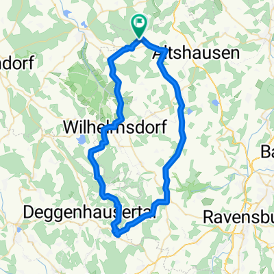
 Rund um Hoßkirch - Atshausen und Saulgau
- Distance
- 32.1 km
- Ascent
- 272 m
- Descent
- 240 m
- Location
- Hoßkirch, Baden-Württemberg, Germany
 Rund um Hoßkirch - Atshausen und Saulgau CLONED FROM ROUTE 94231
- Distance
- 30 km
- Ascent
- 316 m
- Descent
- 313 m
- Location
- Hoßkirch, Baden-Württemberg, Germany
 Hüttenreute Kressbronn
- Distance
- 88.8 km
- Ascent
- 545 m
- Descent
- 744 m
- Location
- Hoßkirch, Baden-Württemberg, Germany
 Hüttenreute Höchsten
- Distance
- 56.5 km
- Ascent
- 667 m
- Descent
- 662 m
- Location
- Hoßkirch, Baden-Württemberg, Germany
 Moderate route in Bad Saulgau
- Distance
- 25.8 km
- Ascent
- 325 m
- Descent
- 362 m
- Location
- Hoßkirch, Baden-Württemberg, Germany
 Bolstern - Lamprechtsweiler
- Distance
- 10.4 km
- Ascent
- 114 m
- Descent
- 121 m
- Location
- Hoßkirch, Baden-Württemberg, Germany
 Hoßkircher runde
- Distance
- 56.7 km
- Ascent
- 807 m
- Descent
- 800 m
- Location
- Hoßkirch, Baden-Württemberg, Germany
 Durch Wald und Flur
- Distance
- 0.6 km
- Ascent
- 16 m
- Descent
- 0 m
- Location
- Hoßkirch, Baden-Württemberg, Germany
Open it in the app